|
search place name
|
||
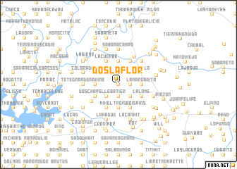
Dos la Flor (Centre, Haiti)Dos la Flor is a town in the Centre region of Haiti. An overview map of the region around Dos la Flor is displayed below.
regional and 3d topo map of Dos la Flor, Haiti ::
Dos la Flor airports ::
The nearest airport is PAP - Port-au-prince Toussaint Louverture Intl, located 63.9 km south west of Dos la Flor.
Other airports nearby include CAP - Cap Haitien Intl (99.4 km north west), BRX - Barahona Maria Montez Intl (102.8 km south east), STI - Santiago Cibao Intl (136.9 km north east), POP - Puerto Plata Gregorio Luperon Intl (159.3 km north east), Nearby towns ::
Bois Pin LʼOrage (0.0km north) //
San Pedre (1.8km east) //
Batier (1.9km south) //
Bois Pin Pose (2.6km north west) //
Garde à Souane (2.6km north east) //
La Bellevue (2.6km north east) //
Dame-Jeanne Cassée (2.6km south east) //
Caranarang (2.6km south west) //
La Margarita (3.5km east) //
Comaidois (3.7km north) //
Bota la Pluie (3.5km west) //
Loba (3.7km south) //
Puello (4.0km north east) //
La Lome (4.0km south east) //
La Cuerbe (4.1km north west) //
Sampède (4.1km north east) //
Dos Chapelle (4.0km south west) //
Mikel (4.1km south west) //
Terre-Blanche (4.1km south west) //
Trois Bois Pins (4.1km south east) //
Roy Sec (4.8km south west) //
Los Rinconcitos (4.9km north east) //
La Fortuna (5.1km north east) //
Polinario (5.1km north east) //
El Carril (5.1km north east) //
Los Lamederos (5.1km north east) //
Tête Grande Ravine (5.3km west) //
Sabana Campo (5.6km north) //
Carabela (5.6km north) //
[all distances 'as the bird flies' and approximate]  Places with similar names to Dos la Flor, Haiti :: Disclaimer :: Information on this page comes without warranty of any kind |
||
|
Where is Dos la Flor? Elevation and coordinates ::
Latitude (lat): 18°55'0"N Longitude (lon): 71°48'0"W
Elevation (approx.): 340m (map arrows pan, magnifying glasses zoom) |
||
|
Visiting Dos la Flor? Hotel/Accommodation ::
Book a hotel in Dos la Flor Travel Guide ::
Buy a travel guide for Haiti rental cars ::
car rental offers GPS waypoint ::
download a GPX waypoint (PoI) of Dos la Flor for your GPS receiver
|
||