|
search place name
|
||
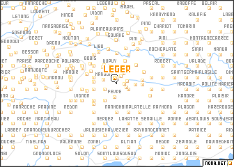
Léger (Sud, Haiti)Léger is a town in the Sud region of Haiti. An overview map of the region around Léger is displayed below.
regional and 3d topo map of Léger, Haiti ::
Léger airports ::
The nearest airport is PAP - Port-au-prince Toussaint Louverture Intl, located 134.7 km east of Léger.
Other airports nearby include CAP - Cap Haitien Intl (207.2 km north east), BCA - Baracoa Playa Gustavo Rizo (242.1 km north west), GAO - Guantanamo Mariana Grajales (253.8 km north west), Nearby towns ::
Vendôme (0.9km north) //
Balou (0.9km north) //
Suzanne (1.1km east) //
Giligo (1.3km north east) //
Julien (1.6km south east) //
Bellevue (1.6km east) //
Dupuy (1.9km north east) //
Fécan (2.0km south east) //
Mare Henry (2.0km south west) //
Mandon (2.1km west) //
Fèvre (2.2km south) //
Dolette (2.7km north) //
Dupuy (2.9km north) //
Changieux (2.9km east) //
Charles Roy (3.3km south west) //
Dupont (3.3km south west) //
Sénac (3.4km north west) //
Biston (3.5km north west) //
Rombeau (3.6km west) //
Païen (3.8km north) //
Petin (3.6km west) //
Tetu (3.6km west) //
Fourreau (3.6km west) //
Nan Hilain (3.9km east) //
Sapotille (3.9km east) //
Jean Patate (4.2km north east) //
Nan Seau (4.4km north west) //
Robuste (4.5km north west) //
Carrefour Libo (4.5km north west) //
[all distances 'as the bird flies' and approximate]  Places with similar names to Léger, Haiti ::
Disclaimer :: Information on this page comes without warranty of any kind |
||
|
Where is Léger? Elevation and coordinates ::
Latitude (lat): 18°22'31"N Longitude (lon): 73°33'0"W
Elevation (approx.): 586m (map arrows pan, magnifying glasses zoom) |
||
|
Visiting Léger? Hotel/Accommodation ::
Book a hotel in Léger Travel Guide ::
Buy a travel guide for Haiti rental cars ::
car rental offers GPS waypoint ::
download a GPX waypoint (PoI) of Léger for your GPS receiver
|
||