|
search place name
|
||
Nan Coton (Centre, Haiti)Nan Coton is a town in the Centre region of Haiti. An overview map of the region around Nan Coton is displayed below.
regional and 3d topo map of Nan Coton, Haiti ::

Nan Coton airports ::
The nearest airport is PAP - Port-au-prince Toussaint Louverture Intl, located 76.6 km south west of Nan Coton.
Other airports nearby include CAP - Cap Haitien Intl (78.1 km north west), BRX - Barahona Maria Montez Intl (121.8 km south east), STI - Santiago Cibao Intl (133.1 km east), POP - Puerto Plata Gregorio Luperon Intl (150.5 km north east), Nearby towns ::
Rangé de Joie (1.9km north) //
Logaillé (1.9km north) //
Boucan Taureau (1.9km south) //
Rio Hondo (1.9km south) //
Bourrine (2.5km north west) //
Nan Pomme (2.5km north west) //
Rodéo (2.5km south east) //
Lacetague (2.5km south west) //
Malential (3.5km west) //
Délé Grando (3.5km west) //
Félipé (3.7km south) //
Thomassique (3.7km south) //
Martial (4.1km north west) //
Nan Roseau (4.1km north west) //
Savane Plate (4.0km south east) //
Nan Saut (4.0km north west) //
Rande Joie (4.0km south west) //
Ravine Sable (4.0km south west) //
Lasterre (5.1km north east) //
Marcelus (5.1km north east) //
Los Ratones (5.1km south east) //
De lʼEau Banquille (5.1km south west) //
De lʼEau Coq (5.3km west) //
Lassière (5.6km north) //
Gros Cajou (5.6km south) //
Losannone (5.6km west) //
Nan Pomme (5.6km west) //
Lilas (5.8km north) //
Matelgate (5.8km south) //
[all distances 'as the bird flies' and approximate] 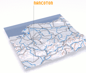 Places with similar names to Nan Coton, Haiti ::
// Nawng-ten (MM)
// Nawngtön (MM)
// Nawngtun (MM)
// Nanga Tuan (ID)
// Nengué Dioni (GA)
// Nan Coton (HT)
// Nan Coton (HT)
// Nan Coton (HT)
// Nan Coton (HT)
// Nan Coton (HT)
Disclaimer :: Information on this page comes without warranty of any kind |
||
|
Where is Nan Coton? Elevation and coordinates ::
Latitude (lat): 19°7'0"N Longitude (lon): 71°50'0"W
Elevation (approx.): 284m (map arrows pan, magnifying glasses zoom) |
||
|
Visiting Nan Coton? Hotel/Accommodation ::
Book a hotel in Nan Coton Travel Guide ::
Buy a travel guide for Haiti rental cars ::
car rental offers GPS waypoint ::
download a GPX waypoint (PoI) of Nan Coton for your GPS receiver
|
||