|
search place name
|
||
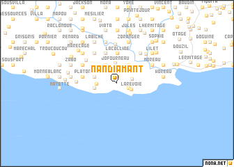
Nan Diamant (Sud-Est, Haiti)Nan Diamant is a town in the Sud-Est region of Haiti. An overview map of the region around Nan Diamant is displayed below.
regional and 3d topo map of Nan Diamant, Haiti ::
Nan Diamant airports ::
The nearest airport is PAP - Port-au-prince Toussaint Louverture Intl, located 73.9 km north east of Nan Diamant.
Other airports nearby include BRX - Barahona Maria Montez Intl (181.6 km east), CAP - Cap Haitien Intl (187.0 km north), Nearby towns ::
La Cour (1.1km north) //
Jackson (2.0km south east) //
La Revoie (2.4km south east) //
Grande Saline (2.4km east) //
Jo Fourneau (3.2km north) //
Fond Dennas (3.1km west) //
Corail lʼAbbé (3.4km north west) //
Saurel (3.4km north west) //
Chomeille (3.4km north east) //
Terre Rouge (3.5km west) //
Piton (3.6km west) //
Bommier (3.6km west) //
La Colline (4.8km north) //
Biron (4.8km north) //
Imby (4.8km north) //
Cadette (5.0km north) //
Platon (5.3km west) //
Dubois (5.3km west) //
Terre Blanche (5.9km north west) //
La Voûte (5.9km north west) //
Bambou (5.9km north west) //
Benoît (6.0km north east) //
Darapin (6.0km north east) //
Corail (6.0km north east) //
Berry (6.0km north west) //
Corail Boutin (6.0km north west) //
Bigot (6.2km north) //
Moreau (6.1km north east) //
Coicou (6.1km north east) //
[all distances 'as the bird flies' and approximate] 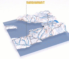 Places with similar names to Nan Diamant, Haiti ::
Disclaimer :: Information on this page comes without warranty of any kind |
||
|
Where is Nan Diamant? Elevation and coordinates ::
Latitude (lat): 18°9'26"N Longitude (lon): 72°50'3"W
Elevation (approx.): 160m (map arrows pan, magnifying glasses zoom) |
||
|
Visiting Nan Diamant? Hotel/Accommodation ::
Book a hotel in Nan Diamant Travel Guide ::
Buy a travel guide for Haiti rental cars ::
car rental offers GPS waypoint ::
download a GPX waypoint (PoI) of Nan Diamant for your GPS receiver
|
||