|
search place name
|
||
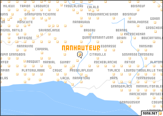
Nan Hauteur (Sud-Est, Haiti)Nan Hauteur is a town in the Sud-Est region of Haiti. An overview map of the region around Nan Hauteur is displayed below.
regional and 3d topo map of Nan Hauteur, Haiti ::
Nan Hauteur airports ::
The nearest airport is PAP - Port-au-prince Toussaint Louverture Intl, located 43.9 km north west of Nan Hauteur.
Other airports nearby include BRX - Barahona Maria Montez Intl (94.8 km east), CAP - Cap Haitien Intl (161.6 km north), STI - Santiago Cibao Intl (193.9 km north east), POP - Puerto Plata Gregorio Luperon Intl (223.2 km north east), Nearby towns ::
Pichon (1.1km south west) //
Grand Bois (2.6km south west) //
Bellevue (2.6km south west) //
Nan Abbé (2.6km south east) //
Tête Morne (2.7km north) //
Grande Tête Rouge (3.2km south west) //
Passe Lafleur (3.7km south) //
Bois de Lance (3.7km north) //
Nan Counouque (3.7km north) //
Citadelle (3.5km east) //
Bois Conte (3.8km west) //
Bel Air (4.0km south west) //
Guimby (4.0km south west) //
Mare Jolie (4.0km north west) //
La Odissee (4.0km north west) //
Mapou (4.0km north west) //
Ca Marchas (4.0km south east) //
Corail (4.0km south east) //
Terre Rouge (4.0km north east) //
Pichon (4.0km north east) //
Ca Compé (4.2km south) //
Caduc (5.1km south west) //
Bois des Hommes (5.1km north west) //
Quartier Saint-Jean (5.1km north east) //
Nan Poteau (5.6km south) //
Bois Tombé (5.6km east) //
Nan Boulaille (5.6km east) //
Roche Blanche (5.6km east) //
Tête Donasse (5.6km east) //
[all distances 'as the bird flies' and approximate]  Places with similar names to Nan Hauteur, Haiti :: Disclaimer :: Information on this page comes without warranty of any kind |
||
|
Where is Nan Hauteur? Elevation and coordinates ::
Latitude (lat): 18°17'0"N Longitude (lon): 72°1'0"W
Elevation (approx.): 648m (map arrows pan, magnifying glasses zoom) |
||
|
Visiting Nan Hauteur? Hotel/Accommodation ::
Book a hotel in Nan Hauteur Travel Guide ::
Buy a travel guide for Haiti rental cars ::
car rental offers GPS waypoint ::
download a GPX waypoint (PoI) of Nan Hauteur for your GPS receiver
|
||