|
search place name
|
||
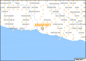
Sous Fort (Sud, Haiti)Sous Fort is a town in the Sud region of Haiti. An overview map of the region around Sous Fort is displayed below.
regional and 3d topo map of Sous Fort, Haiti ::
Sous Fort airports ::
The nearest airport is PAP - Port-au-prince Toussaint Louverture Intl, located 85.2 km north east of Sous Fort.
Other airports nearby include CAP - Cap Haitien Intl (190.6 km north east), BRX - Barahona Maria Montez Intl (197.2 km east), Nearby towns ::
Cavalier (1.7km north east) //
Côtes-de-Fer (1.8km west) //
Plaine Marion (1.9km south east) //
Maréchal (2.6km north east) //
Bac Bois (2.9km north) //
Corail Lhérisson (3.7km north) //
Gris-Gris (4.1km north east) //
Nan Perdu (4.0km north west) //
La Mercie (5.1km north east) //
Boucan Maronne (5.3km north) //
Hatte Joli Bois (5.3km west) //
La Source (5.6km east) //
Morne Blanc (5.6km east) //
Saint-Clos (6.2km north) //
Pornier (6.5km north east) //
Trou Coucou (6.4km east) //
Nan Mombin (6.9km north east) //
Flavil (7.0km east) //
Maillette (7.0km east) //
Dessources (7.4km north) //
Boucan Moran (7.4km north) //
Plaine Galbi (7.3km east) //
Boudary (7.3km west) //
Bel Air (7.3km west) //
Corail Lhérisson (7.7km north west) //
Mayette (8.0km south east) //
Villa (8.2km north east) //
Nan Grié (8.0km north west) //
Mombin (8.2km north west) //
[all distances 'as the bird flies' and approximate]  Places with similar names to Sous Fort, Haiti ::
// Sous Fort (HT)
// Sassoferrato (IT)
Disclaimer :: Information on this page comes without warranty of any kind |
||
|
Where is Sous Fort? Elevation and coordinates ::
Latitude (lat): 18°11'0"N Longitude (lon): 72°59'0"W
Elevation (approx.): 50m (map arrows pan, magnifying glasses zoom) |
||
|
Visiting Sous Fort? Hotel/Accommodation ::
Book a hotel in Sous Fort Travel Guide ::
Buy a travel guide for Haiti rental cars ::
car rental offers GPS waypoint ::
download a GPX waypoint (PoI) of Sous Fort for your GPS receiver
|
||