|
search place name
|
||
Tigas (GrandʼAnse, Haiti)Tigas is a town in the GrandʼAnse region of Haiti. An overview map of the region around Tigas is displayed below.
regional and 3d topo map of Tigas, Haiti ::

Tigas airports ::
The nearest airport is GAO - Guantanamo Mariana Grajales, located 185.1 km north west of Tigas.
Other airports nearby include BCA - Baracoa Playa Gustavo Rizo (196.1 km north), SCU - Santiago De Cuba Antonio Maceo Intl (217.6 km north west), Nearby towns ::
Sajotte (0.0km north) //
Pierre Philippe (1.8km east) //
La Hatte (1.9km north) //
Marcorsi (1.9km north) //
Lato (1.9km south) //
Fouache (1.9km south) //
Morne Chatte (1.9km south) //
Durocher (1.8km west) //
Nan Martin (1.8km west) //
Congo Tout Nu (2.6km north east) //
Morne Louissant (2.6km south east) //
Chajotte (2.6km south east) //
Lesson (2.6km north west) //
Dufor (2.6km north west) //
Saint-Victor (3.7km north) //
Babin (3.7km north) //
Anse Joseph (3.7km north) //
Belle Maison (3.7km south) //
Planche (3.5km west) //
Plaine La Source (3.5km west) //
Daucan (3.5km west) //
Payrette (4.1km north east) //
Germont (4.1km north east) //
La Gombrit (4.0km north east) //
La Gombrie (4.0km north east) //
Laferrière (4.1km south east) //
Défaille (4.1km north west) //
Livrette (4.1km north west) //
Roche Blanche (4.1km south west) //
[all distances 'as the bird flies' and approximate] 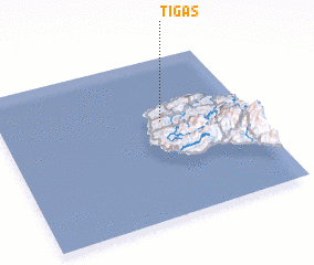 Places with similar names to Tigas, Haiti ::
Disclaimer :: Information on this page comes without warranty of any kind |
||
|
Where is Tigas? Elevation and coordinates ::
Latitude (lat): 18°36'0"N Longitude (lon): 74°21'0"W
Elevation (approx.): 105m (map arrows pan, magnifying glasses zoom) |
||
|
Visiting Tigas? Hotel/Accommodation ::
Book a hotel in Tigas Travel Guide ::
Buy a travel guide for Haiti rental cars ::
car rental offers GPS waypoint ::
download a GPX waypoint (PoI) of Tigas for your GPS receiver
|
||