|
search place name
|
||
Vieux Place (Sud-Est, Haiti)Vieux Place is a town in the Sud-Est region of Haiti. An overview map of the region around Vieux Place is displayed below.
regional and 3d topo map of Vieux Place, Haiti ::

Vieux Place airports ::
The nearest airport is PAP - Port-au-prince Toussaint Louverture Intl, located 73.0 km north east of Vieux Place.
Other airports nearby include CAP - Cap Haitien Intl (178.5 km north east), BRX - Barahona Maria Montez Intl (188.2 km east), Nearby towns ::
Pélagie (1.0km south east) //
La Source (1.9km north) //
Corail (1.9km south) //
Jackson (1.8km east) //
La Faille (1.9km west) //
Fond Palmes (2.6km north east) //
Bordes (2.6km south west) //
Mapou (2.6km south west) //
Mombin (2.6km south east) //
La Ravine (3.5km west) //
Nan Dix-Huit (3.5km west) //
Cascour (3.5km west) //
Pont David (3.7km south) //
Palmiste Lamy (3.8km south east) //
Barbeau (4.0km north east) //
Palmes (4.0km north east) //
Moreau (4.0km south west) //
Grand Fond (4.0km south west) //
Lompré (4.1km north west) //
Nan Coton (4.1km north east) //
Mesilier (4.0km south east) //
Feu (4.0km south east) //
Rac Longue (4.1km south west) //
Courtois (4.1km south west) //
François (4.1km south east) //
Mare Ramier (4.5km west) //
Bistouri (5.1km north) //
Nan Georges (4.9km south east) //
Nan Ramier (5.1km north west) //
[all distances 'as the bird flies' and approximate] 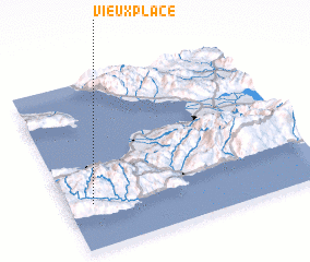 Places with similar names to Vieux Place, Haiti ::
// Vieux Place (HT)
Disclaimer :: Information on this page comes without warranty of any kind |
||
|
Where is Vieux Place? Elevation and coordinates ::
Latitude (lat): 18°16'0"N Longitude (lon): 72°54'0"W
Elevation (approx.): 361m (map arrows pan, magnifying glasses zoom) |
||
|
Visiting Vieux Place? Hotel/Accommodation ::
Book a hotel in Vieux Place Travel Guide ::
Buy a travel guide for Haiti rental cars ::
car rental offers GPS waypoint ::
download a GPX waypoint (PoI) of Vieux Place for your GPS receiver
|
||