|
search place name
|
||
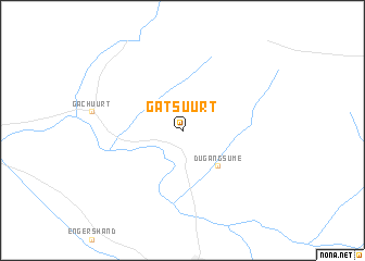
Gatsuurt (Ulaanbaatar, Mongolia)Gatsuurt is a town in the Ulaanbaatar region of Mongolia. An overview map of the region around Gatsuurt is displayed below.
regional and 3d topo map of Gatsuurt, Mongolia ::
Gatsuurt airports ::
The nearest airport is ULN - Ulan Bator Chinggis Khaan Intl, located 37.1 km west of Gatsuurt.
Nearby towns ::
Dugang Süme (4.5km south east) //
[all distances 'as the bird flies' and approximate]  Places with similar names to Gatsuurt, Mongolia ::
// Gatzerreut (DE)
// Kätzerode (DE)
// Gowd-e Sard (IR)
// Kuti Ziārat (PK)
// Gaudissart (FR)
// Gaudeissart (FR)
// Gaudissard (FR)
// Katsaráta (GR)
Disclaimer :: Information on this page comes without warranty of any kind |
||
|
Where is Gatsuurt? Elevation and coordinates ::
Latitude (lat): 47°55'0"N Longitude (lon): 107°15'0"E
Elevation (approx.): 1576m (map arrows pan, magnifying glasses zoom) |
||
|
Visiting Gatsuurt? Hotel/Accommodation ::
Book a hotel in Gatsuurt Travel Guide ::
Buy a travel guide for Mongolia rental cars ::
car rental offers GPS waypoint ::
download a GPX waypoint (PoI) of Gatsuurt for your GPS receiver
|
||