|
search place name
|
||
Amunugama (North Central, Sri Lanka)Amunugama is a town in the North Central region of Sri Lanka. An overview map of the region around Amunugama is displayed below.
regional and 3d topo map of Amunugama, Sri Lanka ::

Amunugama airports ::
The nearest airport is TRR - Trinciomalee China Bay, located 97.6 km north east of Amunugama.
Other airports nearby include CMB - Bandaranaike Intl Colombo (115.2 km south west), RML - Colombo Ratmalana (150.3 km south west), GOY - Galoya Amparai (154.3 km south east), JAF - Jaffna Kankesanturai (195.0 km north), Nearby towns ::
Meegollewa (0.0km north) //
Henparapuwagama (1.9km north) //
Dikwewa (1.9km north) //
Kelegama (1.8km west) //
Ihala Kalankuttiya (1.8km west) //
Midellewa (1.9km south) //
Thoranagama (1.9km south) //
Hiripitiyawa (1.8km east) //
Gallewa (2.6km north west) //
Galagedaragama (2.6km north east) //
Midellewa (2.6km south west) //
Alutwewa (2.6km south west) //
Pittumudiyawa (3.7km north) //
Medawewa (3.7km north) //
Mulanatuwa (3.7km south) //
Appukuttigama (3.7km south) //
Kudawewa (4.1km north west) //
Maha Iluppallama (4.1km north east) //
Konittigama (4.1km north east) //
Senapura (4.1km north east) //
Ihala Bulnewa (4.1km south west) //
Hunupolagama (4.1km south west) //
Nelunpatgama (4.1km south west) //
Katugampolagama (4.1km south west) //
Hiripitiyawa (4.1km south east) //
Bongama (5.2km south west) //
Pahalagama (5.2km south west) //
Maha Meegassegama (5.2km north east) //
Walpalugama (5.5km east) //
[all distances 'as the bird flies' and approximate] 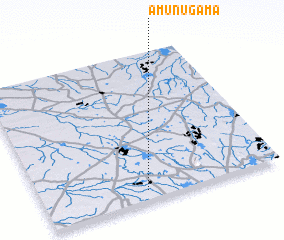 Places with similar names to Amunugama, Sri Lanka ::
Disclaimer :: Information on this page comes without warranty of any kind |
||
|
Where is Amunugama? Elevation and coordinates ::
Latitude (lat): 8°4'0"N Longitude (lon): 80°26'0"E
Elevation (approx.): 104m (map arrows pan, magnifying glasses zoom) |
||
|
Visiting Amunugama? Hotel/Accommodation ::
Book a hotel in Amunugama Travel Guide ::
Buy a travel guide for Sri Lanka rental cars ::
car rental offers GPS waypoint ::
download a GPX waypoint (PoI) of Amunugama for your GPS receiver
|
||