|
search place name
|
||
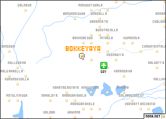
Bokkeyaya (North Eastern, Sri Lanka)Bokkeyaya is a town in the North Eastern region of Sri Lanka. An overview map of the region around Bokkeyaya is displayed below.
regional and 3d topo map of Bokkeyaya, Sri Lanka ::
Bokkeyaya airports ::
The nearest airport is GOY - Galoya Amparai, located 4.9 km east of Bokkeyaya.
Other airports nearby include TRR - Trinciomalee China Bay (138.7 km north), CMB - Bandaranaike Intl Colombo (188.6 km west), RML - Colombo Ratmalana (196.4 km west), Nearby towns ::
Galahitiyagoda (1.8km east) //
Bokkebedda (3.7km north) //
Alutkotelinda (4.1km north east) //
Siyambalagahamadama (4.1km north east) //
Madanakanda (5.9km north) //
Uhana (5.8km east) //
Welikahagolla (5.8km east) //
Pita-ela (6.6km north east) //
Kohombana (6.7km north east) //
Veeradiya (7.4km east) //
Himidurawa (7.6km south) //
Burutagolla (7.8km north east) //
Kahatagasyaya (8.3km south west) //
Warankata (8.3km north east) //
Kondavattavan (9.2km south east) //
[all distances 'as the bird flies' and approximate]  Places with similar names to Bokkeyaya, Sri Lanka ::
// Bakuyeya (GH)
Disclaimer :: Information on this page comes without warranty of any kind |
||
|
Where is Bokkeyaya? Elevation and coordinates ::
Latitude (lat): 7°21'0"N Longitude (lon): 81°35'0"E
Elevation (approx.): 42m (map arrows pan, magnifying glasses zoom) |
||
|
Visiting Bokkeyaya? Hotel/Accommodation ::
Book a hotel in Bokkeyaya Travel Guide ::
Buy a travel guide for Sri Lanka rental cars ::
car rental offers GPS waypoint ::
download a GPX waypoint (PoI) of Bokkeyaya for your GPS receiver
|
||