|
search place name
|
||
Ittavil (North Eastern, Sri Lanka)Ittavil is a town in the North Eastern region of Sri Lanka. An overview map of the region around Ittavil is displayed below.
regional and 3d topo map of Ittavil, Sri Lanka ::

Ittavil airports ::
The nearest airport is JAF - Jaffna Kankesanturai, located 32.3 km north west of Ittavil.
Other airports nearby include TRR - Trinciomalee China Bay (154.0 km south east), TRZ - Tiruchchirappalli Tiruchirappalli (216.1 km north west), Nearby towns ::
Periyapalai (2.6km south east) //
Tampakamam (2.6km south east) //
Vempotukeni (2.6km south west) //
Pallai (3.7km south) //
Puloppalai (3.7km south) //
Mukamalai (3.7km west) //
Vannankeni (4.1km south east) //
Mamunai (4.1km north east) //
Kudarappu (4.1km north east) //
Kilali (5.8km west) //
Tanmakkeni (5.9km south) //
Chempiyanpattu (5.8km east) //
Eluthumadduval South (5.8km west) //
Alipalai (5.9km south) //
Eluthumadduval North (6.7km north west) //
Vidattalpalai (7.3km west) //
Chempiyanpattu (7.5km east) //
Karampakam (7.5km west) //
Oddupeli (7.5km west) //
Nakarkoyil (7.6km north) //
Soranpattu (7.8km south east) //
Masar (8.2km south east) //
Malvil (9.2km south east) //
[all distances 'as the bird flies' and approximate] 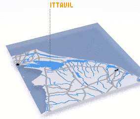 Places with similar names to Ittavil, Sri Lanka ::
Disclaimer :: Information on this page comes without warranty of any kind |
||
|
Where is Ittavil? Elevation and coordinates ::
Latitude (lat): 9°38'0"N Longitude (lon): 80°19'0"E
Elevation (approx.): 9m (map arrows pan, magnifying glasses zoom) |
||
|
Visiting Ittavil? Hotel/Accommodation ::
Book a hotel in Ittavil Travel Guide ::
Buy a travel guide for Sri Lanka rental cars ::
car rental offers GPS waypoint ::
download a GPX waypoint (PoI) of Ittavil for your GPS receiver
|
||