|
search place name
|
||
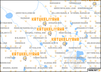
Katukeliyawa (North Central, Sri Lanka)Katukeliyawa is a town in the North Central region of Sri Lanka. An overview map of the region around Katukeliyawa is displayed below.
regional and 3d topo map of Katukeliyawa, Sri Lanka ::
Katukeliyawa airports ::
The nearest airport is TRR - Trinciomalee China Bay, located 94.7 km east of Katukeliyawa.
Other airports nearby include CMB - Bandaranaike Intl Colombo (143.7 km south), JAF - Jaffna Kankesanturai (156.7 km north), RML - Colombo Ratmalana (181.4 km south), GOY - Galoya Amparai (184.8 km south east), Nearby towns ::
Pahala Diganegama (1.8km west) //
Niyangama (1.9km north) //
Pusiyankulama (1.9km south) //
Madurupitigama (2.6km north west) //
Kokkichchiya (2.6km south west) //
Palugaswewa (2.6km north east) //
Donpalugama (3.7km north) //
Medawachchiya (3.7km south) //
Elayapattuwa (3.7km west) //
Katukeliyawa (4.1km north west) //
Kokichchikulama (4.1km south west) //
Dura Bulankulama (4.1km south west) //
Hingurugama (4.1km north east) //
Keppittiyawa (4.1km south east) //
Iluppukulama (4.1km south east) //
Miminnewatta (4.1km south west) //
Talakolawewa (4.1km north east) //
Ihala Anduketiyawa (4.1km south east) //
Karambewa (4.1km south east) //
Pahala Hammillewa (4.1km south east) //
Pahala Kudawewa (4.1km south east) //
Maningamua (5.2km north west) //
Ihala Hammillewa (5.2km south east) //
Lolugaswewa (5.2km south east) //
Galkadawala (5.5km east) //
Mawatawewa (5.5km east) //
Katu Puliyankulama (5.5km west) //
Katugampolagama (5.9km north) //
Periya Kallanchiya (5.9km south) //
[all distances 'as the bird flies' and approximate] 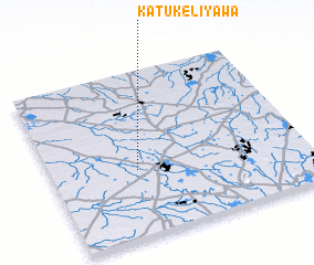 Places with similar names to Katukeliyawa, Sri Lanka ::
// Katukeliyawa (LK)
// Katukeliyawa (LK)
// Katukeliyawa (LK)
// Katukeliyawa (LK)
// Katukeliyawa (LK)
// Katukeliyawa (LK)
// Katukeliyawa (LK)
// Katukeliyawa (LK)
// Katukeliyawa (LK)
// Katukeliyawa (LK)
Disclaimer :: Information on this page comes without warranty of any kind |
||
|
Where is Katukeliyawa? Elevation and coordinates ::
Latitude (lat): 8°24'0"N Longitude (lon): 80°20'0"E
Elevation (approx.): 89m (map arrows pan, magnifying glasses zoom) |
||
|
Visiting Katukeliyawa? Hotel/Accommodation ::
Book a hotel in Katukeliyawa Travel Guide ::
Buy a travel guide for Sri Lanka rental cars ::
car rental offers GPS waypoint ::
download a GPX waypoint (PoI) of Katukeliyawa for your GPS receiver
|
||