|
search place name
|
||
Pallegama (Central, Sri Lanka)Pallegama is a town in the Central region of Sri Lanka. An overview map of the region around Pallegama is displayed below.
regional and 3d topo map of Pallegama, Sri Lanka ::

Pallegama airports ::
The nearest airport is CMB - Bandaranaike Intl Colombo, located 88.4 km west of Pallegama.
Other airports nearby include RML - Colombo Ratmalana (104.1 km south west), GOY - Galoya Amparai (105.9 km east), TRR - Trinciomalee China Bay (143.2 km north east), Nearby towns ::
Migammana Ihalagammedda (0.0km north) //
Udurawana (0.0km north) //
Migammana Mahagammedda (0.0km north) //
Narandanda (1.8km east) //
Walpoladeniya (1.8km west) //
Dikirillagolla (1.8km west) //
Uda Talawinnamadige (1.8km west) //
Uda Talawinna Megodagammedda (1.8km west) //
Yatirawana (1.9km south) //
Alakoladeniya (1.9km south) //
Gunnepana Gabadagama (1.9km south) //
Doragomuwa (1.9km north) //
Malagekumbura (1.9km north) //
Udurawana Megodagammedda (1.9km north) //
Migammana Pallegama (1.9km south) //
Migammana (1.9km south) //
Yatawara (1.9km north) //
Madawala Madige (1.9km south) //
Madawala (1.9km south) //
Wattegama (2.2km east) //
Pitiyegedara (2.6km south east) //
Pallegama Ihalagammedda (2.6km south east) //
Walala Megodagammedda (2.6km south east) //
Wattegedara (2.6km south west) //
Uda Talawinna (2.6km south west) //
Hatiyaldeniya (2.6km north west) //
Gunnepana Pallegammedda (2.6km south west) //
Gunnepana Madige (2.6km south west) //
Hangarandeniya (2.6km north west) //
[all distances 'as the bird flies' and approximate] 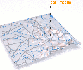 Places with similar names to Pallegama, Sri Lanka ::
// Pelkum (DE)
// Pelkum (DE)
// Palaiokómi (GR)
// Pawłokoma (PL)
// Paloquemao (CO)
// Palacamá (GT)
// Pilgamma (IN)
// Palagama (LK)
// Palagama (LK)
// Paligama (LK)
Disclaimer :: Information on this page comes without warranty of any kind |
||
|
Where is Pallegama? Elevation and coordinates ::
Latitude (lat): 7°21'0"N Longitude (lon): 80°40'0"E
Elevation (approx.): 504m (map arrows pan, magnifying glasses zoom) |
||
|
Visiting Pallegama? Hotel/Accommodation ::
Book a hotel in Pallegama Travel Guide ::
Buy a travel guide for Sri Lanka rental cars ::
car rental offers GPS waypoint ::
download a GPX waypoint (PoI) of Pallegama for your GPS receiver
|
||