|
search place name
|
||
Pallegama (Southern, Sri Lanka)Pallegama is a town in the Southern region of Sri Lanka. An overview map of the region around Pallegama is displayed below.
regional and 3d topo map of Pallegama, Sri Lanka ::

Pallegama airports ::
The nearest airport is TRR - Trinciomalee China Bay, located 90.8 km north east of Pallegama.
Other airports nearby include CMB - Bandaranaike Intl Colombo (117.1 km south west), GOY - Galoya Amparai (124.0 km south east), RML - Colombo Ratmalana (147.0 km south west), JAF - Jaffna Kankesanturai (218.4 km north), Nearby towns ::
Pelwehera (1.2km south east) //
Batalawatta (1.5km north west) //
Etorahena (1.5km north west) //
Kotakittigewewa (1.6km north east) //
Dambullagama (2.6km south) //
Bulagala (2.7km west) //
Pahala Bulagala (2.9km north west) //
Panditayagama (2.9km north west) //
Kitulhitiyawa (2.9km north west) //
Moragaswewa (2.9km north west) //
Ihala Bakmigahaulpota (3.2km north) //
Habarattawala (3.6km south west) //
Galwetiyaya (3.6km south west) //
Ihala Kitulhitiyawa (4.1km north west) //
Debaragoda (4.1km north west) //
Ihala Bakmigahaulpota (4.1km north west) //
Kodikaragama (4.1km north west) //
Inamaluwa (4.3km north east) //
Hinguruwelpitiya (4.5km west) //
Bambaragaleyaya (5.1km south west) //
Dambulla (5.1km south) //
Timbiriwala (5.1km south west) //
Madatugama (5.3km north west) //
Kehelwatta (5.4km north west) //
Dunumadalawa (5.4km north west) //
Achari Madatugama (5.6km north west) //
Kotagala (5.6km north west) //
Padeniya (6.2km south) //
Ratmalagaha-ela (6.3km south) //
[all distances 'as the bird flies' and approximate] 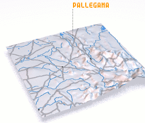 Places with similar names to Pallegama, Sri Lanka ::
// Pelkum (DE)
// Pelkum (DE)
// Palaiokómi (GR)
// Pawłokoma (PL)
// Paloquemao (CO)
// Palacamá (GT)
// Pilgamma (IN)
// Palagama (LK)
// Palagama (LK)
// Paligama (LK)
Disclaimer :: Information on this page comes without warranty of any kind |
||
|
Where is Pallegama? Elevation and coordinates ::
Latitude (lat): 7°54'20"N Longitude (lon): 80°39'26"E
Elevation (approx.): 163m (map arrows pan, magnifying glasses zoom) |
||
|
Visiting Pallegama? Hotel/Accommodation ::
Book a hotel in Pallegama Travel Guide ::
Buy a travel guide for Sri Lanka rental cars ::
car rental offers GPS waypoint ::
download a GPX waypoint (PoI) of Pallegama for your GPS receiver
|
||