|
search place name
|
||
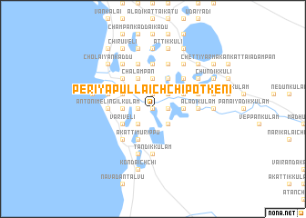
Periyapullaichchipotkeni (North Eastern, Sri Lanka)Periyapullaichchipotkeni is a town in the North Eastern region of Sri Lanka. An overview map of the region around Periyapullaichchipotkeni is displayed below.
regional and 3d topo map of Periyapullaichchipotkeni, Sri Lanka ::
Periyapullaichchipotkeni airports ::
The nearest airport is JAF - Jaffna Kankesanturai, located 112.0 km north of Periyapullaichchipotkeni.
Other airports nearby include TRR - Trinciomalee China Bay (134.7 km east), CMB - Bandaranaike Intl Colombo (177.6 km south), RML - Colombo Ratmalana (217.2 km south), IXM - Madurai (238.0 km north west), Nearby towns ::
Chadayappankulam (0.0km north) //
Maraikkayarur (0.0km north) //
Ilantaimoddaikkulam (0.0km north) //
Mettanveli (1.8km west) //
Nochchikkulam (1.8km west) //
Annammakulam (1.9km north) //
Vannakulam (1.8km east) //
Panikkappettankulam (1.8km east) //
Veppankulam (1.8km east) //
Ittikkulam (1.8km east) //
Kulankulam (2.6km south west) //
Putuveli (2.6km south west) //
Perunkadduchirukkulam (2.6km south east) //
Mannarmudikattamannakkamadu (2.6km north east) //
Kalimoddaipuliyankulam (2.6km north east) //
Ilantaikkulam (3.7km west) //
Manalkulam (3.7km west) //
Pandaraveli (3.7km west) //
Alavakkaisirukkulam (3.7km west) //
Vakkappaddankandal-Metpuliyankulam (3.7km north) //
Purandiveli (3.7km north) //
Nochchikkulam (3.7km north) //
Puthukulam (3.7km east) //
Kumakulam (3.7km east) //
Pichchaivanivanedunkulam (3.7km east) //
Pallalankulam (3.7km east) //
Musali (4.1km south west) //
Palaiyatisirukkulam (4.1km south west) //
Variveli (4.1km south west) //
[all distances 'as the bird flies' and approximate] 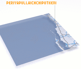 Places with similar names to Periyapullaichchipotkeni, Sri Lanka :: Disclaimer :: Information on this page comes without warranty of any kind |
||
|
Where is Periyapullaichchipotkeni? Elevation and coordinates ::
Latitude (lat): 8°47'0"N Longitude (lon): 79°59'0"E
Elevation (approx.): 12m (map arrows pan, magnifying glasses zoom) |
||
|
Visiting Periyapullaichchipotkeni? Hotel/Accommodation ::
Book a hotel in Periyapullaichchipotkeni Travel Guide ::
Buy a travel guide for Sri Lanka rental cars ::
car rental offers GPS waypoint ::
download a GPX waypoint (PoI) of Periyapullaichchipotkeni for your GPS receiver
|
||