|
search place name
|
||
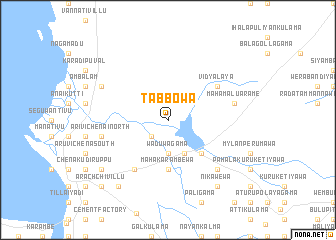
Tabbowa (North Western, Sri Lanka)Tabbowa is a town in the North Western region of Sri Lanka. An overview map of the region around Tabbowa is displayed below.
regional and 3d topo map of Tabbowa, Sri Lanka ::
Tabbowa airports ::
The nearest airport is CMB - Bandaranaike Intl Colombo, located 100.0 km south of Tabbowa.
Other airports nearby include RML - Colombo Ratmalana (139.6 km south), TRR - Trinciomalee China Bay (146.5 km east), JAF - Jaffna Kankesanturai (189.6 km north), GOY - Galoya Amparai (204.1 km south east), Nearby towns ::
Kuweni Nuwara (2.6km south west) //
Waduwagama (3.7km south) //
Pawathamaduwa (3.7km south) //
Olukkiliya (4.1km south east) //
Karuwalagaswewa (5.2km south east) //
Mahakarambewa (5.6km south) //
Sellankandal (6.7km south west) //
Vidyalaya (6.6km north east) //
Arivichenai North (7.6km west) //
Mahamalu Arame (7.6km east) //
Murukkuwatawana (7.8km south east) //
Vattakandal (8.2km north west) //
Maduramadu Vembu (9.2km south west) //
Nikawewa (9.2km south east) //
Sirambiyadi (9.2km south west) //
Arachchivillu (10.4km south west) //
[all distances 'as the bird flies' and approximate] 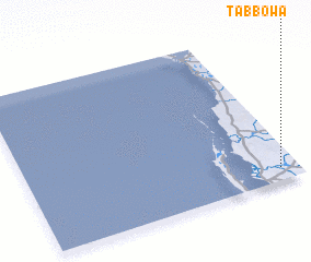 Places with similar names to Tabbowa, Sri Lanka ::
Disclaimer :: Information on this page comes without warranty of any kind |
||
|
Where is Tabbowa? Elevation and coordinates ::
Latitude (lat): 8°5'0"N Longitude (lon): 79°56'0"E
Elevation (approx.): 20m (map arrows pan, magnifying glasses zoom) |
||
|
Visiting Tabbowa? Hotel/Accommodation ::
Book a hotel in Tabbowa Travel Guide ::
Buy a travel guide for Sri Lanka rental cars ::
car rental offers GPS waypoint ::
download a GPX waypoint (PoI) of Tabbowa for your GPS receiver
|
||