|
search place name
|
||
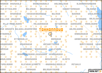
Tammannawa (North Western, Sri Lanka)Tammannawa is a town in the North Western region of Sri Lanka. An overview map of the region around Tammannawa is displayed below.
regional and 3d topo map of Tammannawa, Sri Lanka ::
Tammannawa airports ::
The nearest airport is CMB - Bandaranaike Intl Colombo, located 99.8 km south west of Tammannawa.
Other airports nearby include TRR - Trinciomalee China Bay (110.5 km north east), RML - Colombo Ratmalana (134.6 km south west), GOY - Galoya Amparai (152.1 km south east), JAF - Jaffna Kankesanturai (208.5 km north), Nearby towns ::
Jalatgama (0.0km north) //
Kadurugaswewa (0.0km north) //
Molapolayagama (0.0km north) //
Galgiriyawa (1.9km south) //
Wambotuwewa (1.9km south) //
Karagaswewa (1.9km south) //
Ulpota (1.9km south) //
Alutgama (1.9km south) //
Alutwewa (1.9km south) //
Maha Embogama (1.8km west) //
Palugahakotuwa (1.8km west) //
Siyambalagaswewa (1.8km west) //
Kumbukkadawala (1.8km west) //
Wegedaragama (1.8km west) //
Rembewa (1.9km north) //
Galhinna (1.9km north) //
Timbiriyawa (1.8km east) //
Kambuwatawana (1.8km east) //
Borawewagurunnehelegama (1.8km east) //
Galapitawewa (1.8km east) //
Borawewa (2.6km south east) //
Pohorawatta (2.6km south east) //
Konwewa (2.6km south east) //
Kaduruwewa (2.6km north west) //
Hiddewa (2.6km north west) //
Gonamaditta (2.6km north west) //
Galapitawela (2.6km north west) //
Talakolawewa (2.6km north east) //
Kalawitigedara (2.6km north east) //
[all distances 'as the bird flies' and approximate]  Places with similar names to Tammannawa, Sri Lanka ::
// Dominowo (PL)
// Damunowa (LK)
// Demunnewa (LK)
// Tammannewa (LK)
// Tammannewa (LK)
// Tammannewa (LK)
// Tammannewa (LK)
// Tammannewa (LK)
// Tammannewa (LK)
// Tammannewa (LK)
Disclaimer :: Information on this page comes without warranty of any kind |
||
|
Where is Tammannawa? Elevation and coordinates ::
Latitude (lat): 7°56'0"N Longitude (lon): 80°23'0"E
Elevation (approx.): 421m (map arrows pan, magnifying glasses zoom) |
||
|
Visiting Tammannawa? Hotel/Accommodation ::
Book a hotel in Tammannawa Travel Guide ::
Buy a travel guide for Sri Lanka rental cars ::
car rental offers GPS waypoint ::
download a GPX waypoint (PoI) of Tammannawa for your GPS receiver
|
||