|
search place name
|
||
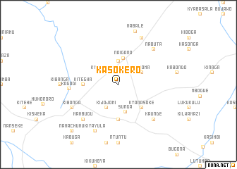
Kasokero (Busoga, Uganda)Kasokero is a town in the Busoga region of Uganda. An overview map of the region around Kasokero is displayed below.
regional and 3d topo map of Kasokero, Uganda ::
Kasokero airports ::
The nearest airport is BUX - Bunia, located 97.7 km north west of Kasokero.
Other airports nearby include EBB - Entebbe Intl (203.1 km south east), Nearby towns ::
Kabonerwa (1.9km north) //
Kyangamwoyo (2.6km north west) //
Mugalike (3.7km north) //
Lutoma (4.1km north east) //
Kijojomi (4.1km south west) //
Naigana (4.2km north) //
Sunga (4.5km south) //
Kyanasoke (5.2km south east) //
Lwelu (5.6km south) //
Kitegwa (5.6km west) //
Kagadi (7.8km west) //
Kaunde (7.9km south east) //
Mambugu (7.9km south west) //
Nabuta (7.9km north east) //
Kitemuzi (8.3km north east) //
Kibanga (8.3km south west) //
Kiyayula (8.3km south west) //
Mabale (8.8km north) //
Namachumu (10.5km south west) //
[all distances 'as the bird flies' and approximate] 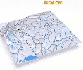 Places with similar names to Kasokero, Uganda ::
// Quşqara (AZ)
// Case Ocaro (IT)
// Casqueira (PT)
// Kozia Góra (PL)
// Kozia Góra (PL)
// Kozia Góra (PL)
// Kozia Góra (PL)
// Koziagóra (PL)
// Csikér (HU)
// Csikéria (HU)
Disclaimer :: Information on this page comes without warranty of any kind |
||
|
Where is Kasokero? Elevation and coordinates ::
Latitude (lat): 0°58'0"S Longitude (lon): 30°52'0"E
Elevation (approx.): 1228m (map arrows pan, magnifying glasses zoom) |
||
|
Visiting Kasokero? Hotel/Accommodation ::
Book a hotel in Kasokero Travel Guide ::
Buy a travel guide for Uganda rental cars ::
car rental offers GPS waypoint ::
download a GPX waypoint (PoI) of Kasokero for your GPS receiver
|
||