|
search place name
|
||
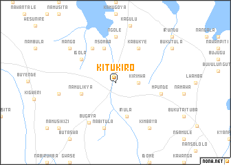
Kitukiro (Busoga, Uganda)Kitukiro is a town in the Busoga region of Uganda. An overview map of the region around Kitukiro is displayed below.
regional and 3d topo map of Kitukiro, Uganda ::
Kitukiro airports ::
The nearest airport is SRT - Soroti, located 74.2 km north east of Kitukiro.
Other airports nearby include EBB - Entebbe Intl (154.1 km south west), KTL - Kitale (187.5 km east), KIS - Kisumu (211.1 km south east), EDL - Eldoret Intl (232.8 km east), Nearby towns ::
Budola (1.9km north) //
Kirimwa (3.7km east) //
Nsomba (5.9km north) //
Inula (5.9km south) //
Namulikya (5.9km west) //
Byero (6.7km north west) //
Igola (6.7km north west) //
Kabukye (6.7km north east) //
Ngole (7.4km north) //
Nabitula (7.6km south) //
Mpunde (7.6km east) //
Lukotaime (7.6km east) //
Bugaya (7.8km south west) //
Mango (9.3km north west) //
Kimbaya (9.3km south east) //
[all distances 'as the bird flies' and approximate] 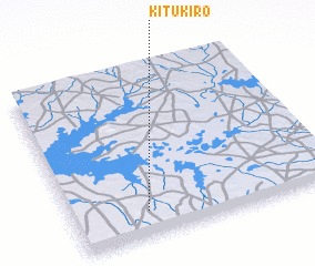 Places with similar names to Kitukiro, Uganda ::
// Quatoquará (BR)
// Kadıkırı (TR)
// Kutkor (UA)
// Katagor (RU)
// Goda Goro (ET)
// Kitay Gora (RU)
// Kete Gara (ET)
// Godāgāri (BD)
// Gotgāri (BD)
// Kādigar (BD)
Disclaimer :: Information on this page comes without warranty of any kind |
||
|
Where is Kitukiro? Elevation and coordinates ::
Latitude (lat): 1°9'0"N Longitude (lon): 33°17'0"E
Elevation (approx.): 1059m (map arrows pan, magnifying glasses zoom) |
||
|
Visiting Kitukiro? Hotel/Accommodation ::
Book a hotel in Kitukiro Travel Guide ::
Buy a travel guide for Uganda rental cars ::
car rental offers GPS waypoint ::
download a GPX waypoint (PoI) of Kitukiro for your GPS receiver
|
||