|
search place name
|
||
Ali (Maradi, Niger)Ali is a town in the Maradi region of Niger. An overview map of the region around Ali is displayed below.
regional and 3d topo map of Ali, Niger ::

Ali airports ::
The nearest airport is MFG - Maradi, located 79.2 km south of Ali.
Other airports nearby include ZND - Zinder (200.4 km east), THZ - Tahoua (219.2 km west), SKO - Sokoto Sadiq Abubakar Iii Intl (257.8 km south west), Nearby towns ::
Dan Kandé (1.8km west) //
Rijia Aman (1.9km north) //
Guidan Gaya (1.8km east) //
Ajia Saboa (2.6km south west) //
Dogon Hano (3.6km east) //
Dan Zabo (4.1km north west) //
Dan Yaba (4.1km north east) //
Guidan Bouzou (4.0km south east) //
Dan Kané (5.2km north east) //
Atalabawa (5.8km south) //
Bajadani (5.7km west) //
Guidan Labo Ada (5.8km north) //
Ékaba (6.6km south west) //
Goundidi (6.5km south east) //
Dan Malam (6.5km south east) //
Kahi (7.4km west) //
Agar (7.4km east) //
Guidan Guingué (7.6km south) //
Guidan Kalé (7.4km east) //
Dan Ja Amouté (7.7km south west) //
Gajiri (7.7km south west) //
Bantacha (7.7km north east) //
Guidan Mani Ada (8.2km north west) //
Namata (8.1km south west) //
Dadin Tamro (8.1km south east) //
Guidan Gwari (9.1km north west) //
Guidan Inda (9.2km south west) //
Guidan Ouari (9.5km south east) //
[all distances 'as the bird flies' and approximate] 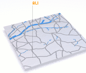 Places with similar names to Ali, Niger ::
Disclaimer :: Information on this page comes without warranty of any kind |
||
|
Where is Ali? Elevation and coordinates ::
Latitude (lat): 14°13'0"N Longitude (lon): 7°11'0"E
Elevation (approx.): 409m (map arrows pan, magnifying glasses zoom) |
||
|
Visiting Ali? Hotel/Accommodation ::
Book a hotel in Ali Travel Guide ::
Buy a travel guide for Niger rental cars ::
car rental offers GPS waypoint ::
download a GPX waypoint (PoI) of Ali for your GPS receiver
|
||