|
search place name
|
||
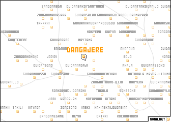
Dan Gajéré (Maradi, Niger)Dan Gajéré is a town in the Maradi region of Niger. An overview map of the region around Dan Gajéré is displayed below.
regional and 3d topo map of Dan Gajéré, Niger ::
Dan Gajéré airports ::
The nearest airport is MFG - Maradi, located 109.6 km south of Dan Gajéré.
Other airports nearby include ZND - Zinder (201.1 km south east), Nearby towns ::
Rikiskama (1.8km east) //
Laléwa (1.9km north) //
Guidan Gonda (2.6km south east) //
Guidan Magaji (2.6km south west) //
Guidan Jika (2.6km north west) //
Maytama (3.7km north) //
Saïdawa Konkorma (4.0km north west) //
Guidan Kané Mekahi (5.2km south east) //
Bouzouzoum (5.6km south) //
Makyéra (5.8km north) //
Bawoli (5.8km south) //
Dan Koulou (5.8km south west) //
Guidan Sami (6.5km south west) //
Zangon Touno (6.6km south east) //
Guidan Rabo (6.5km north west) //
Dan Gao (7.4km south) //
Jariri (7.2km west) //
Guidan Sami (7.6km south) //
Guidan Kané Dan Madougou (7.6km north) //
Kweyni (7.7km north east) //
Tokala (8.2km south east) //
Sankarné (9.2km south west) //
Soké Soké Saboa (9.1km south east) //
Illio (9.1km south east) //
Guidan Roro (10.3km south east) //
Ardo Djédo (10.3km north west) //
[all distances 'as the bird flies' and approximate]  Places with similar names to Dan Gajéré, Niger ::
// Dingajuri (SD)
// Dingajurie (SD)
// Tangjŏ-ri (KP)
// Tongji-ri (KP)
// Tongju-ri (KP)
// Tongjo-ri (KR)
// Tangjŏ-ri (KP)
// T'ongji-ri (KP)
// Danna Kāgiār (PK)
Disclaimer :: Information on this page comes without warranty of any kind |
||
|
Where is Dan Gajéré? Elevation and coordinates ::
Latitude (lat): 14°29'0"N Longitude (lon): 7°16'0"E
Elevation (approx.): 443m (map arrows pan, magnifying glasses zoom) |
||
|
Visiting Dan Gajéré? Hotel/Accommodation ::
Book a hotel in Dan Gajéré Travel Guide ::
Buy a travel guide for Niger rental cars ::
car rental offers GPS waypoint ::
download a GPX waypoint (PoI) of Dan Gajéré for your GPS receiver
|
||