|
search place name
|
||
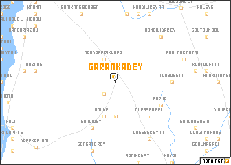
Garankadey (Dosso, Niger)Garankadey is a town in the Dosso region of Niger. An overview map of the region around Garankadey is displayed below.
regional and 3d topo map of Garankadey, Niger ::
Garankadey airports ::
The nearest airport is NIM - Niamey Diori Hamani, located 101.7 km west of Garankadey.
Nearby towns ::
Dey Tégui Yarou (2.6km south west) //
Ganda Béri Kwara (4.1km north west) //
Dey Tégui Assane (5.6km south) //
Goudel (5.8km south) //
Guéssé Béri (7.8km south east) //
Sandidey (8.2km south west) //
Barma (8.1km south east) //
Komdili Darey (10.3km north east) //
[all distances 'as the bird flies' and approximate] 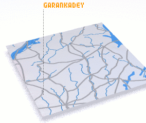 Places with similar names to Garankadey, Niger ::
// Corangot (PH)
// Gurengad (PH)
// Korniaktów (PL)
// Karankut (UA)
// Green Gate (US)
// Greengate (US)
// Kaôh Rŭng (3) (KH)
// Krâng Téh (KH)
// Karnākāti (BD)
// Kourangati (TD)
Disclaimer :: Information on this page comes without warranty of any kind |
||
|
Where is Garankadey? Elevation and coordinates ::
Latitude (lat): 13°17'0"N Longitude (lon): 3°6'0"E
Elevation (approx.): 237m (map arrows pan, magnifying glasses zoom) |
||
|
Visiting Garankadey? Hotel/Accommodation ::
Book a hotel in Garankadey Travel Guide ::
Buy a travel guide for Niger rental cars ::
car rental offers GPS waypoint ::
download a GPX waypoint (PoI) of Garankadey for your GPS receiver
|
||