|
search place name
|
||
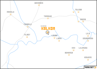
Kalkom (Niamey, Niger)Kalkom is a town in the Niamey region of Niger. An overview map of the region around Kalkom is displayed below.
regional and 3d topo map of Kalkom, Niger ::
Kalkom airports ::
The nearest airport is NIM - Niamey Diori Hamani, located 90.7 km north east of Kalkom.
Nearby towns ::
 Places with similar names to Kalkom, Niger ::
// Calquim (PT)
// Kaliakiemiai (LT)
// Güllüçam (TR)
// Kalkım (TR)
// Kalkım (TR)
// Kulle-Kimi (RU)
// Claycomo (US)
// Koulikamè (BJ)
// Kelgueme (BF)
// Kolkouom (BF)
Disclaimer :: Information on this page comes without warranty of any kind |
||
|
Where is Kalkom? Elevation and coordinates ::
Latitude (lat): 13°2'18"N Longitude (lon): 1°28'45"E
Elevation (approx.): 227m (map arrows pan, magnifying glasses zoom) |
||
|
Visiting Kalkom? Hotel/Accommodation ::
Book a hotel in Kalkom Travel Guide ::
Buy a travel guide for Niger rental cars ::
car rental offers GPS waypoint ::
download a GPX waypoint (PoI) of Kalkom for your GPS receiver
|
||