|
search place name
|
||
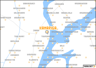
Kamariga (Dosso, Niger)Kamariga is a town in the Dosso region of Niger. An overview map of the region around Kamariga is displayed below.
regional and 3d topo map of Kamariga, Niger ::
Kamariga airports ::
The nearest airport is SKO - Sokoto Sadiq Abubakar Iii Intl, located 176.1 km east of Kamariga.
Other airports nearby include NIM - Niamey Diori Hamani (176.3 km north west), Nearby towns ::
Kwara Saré (1.9km south) //
Tounga Mazigo (1.9km south) //
Kamakadji (1.9km south) //
Bomboro (2.6km south east) //
Angoa Dagne (3.6km east) //
Rouga Tsisso (4.1km south west) //
Sagadé (4.1km south east) //
Angoa Laboa (4.1km north east) //
Gouma (4.1km north east) //
Zabori (4.5km west) //
Kassadabi (5.2km south east) //
Tiwatié (5.2km south west) //
Angoa Sama (5.6km south) //
Massama (5.4km east) //
Bouma (5.8km south) //
Bodari (5.8km south) //
Diamibougari (6.6km south west) //
Angoa Damagani (6.6km north east) //
Tiangalla (7.2km west) //
Madawaki (7.6km south) //
Lagéré (7.5km east) //
Angoa Lélaba (7.6km north) //
Balé (7.8km south east) //
Farin Doutchi (8.2km south east) //
Timba (8.1km south east) //
Agonga (9.1km north east) //
Abdouladji (10.4km north east) //
[all distances 'as the bird flies' and approximate] 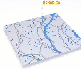 Places with similar names to Kamariga, Niger ::
Disclaimer :: Information on this page comes without warranty of any kind |
||
|
Where is Kamariga? Elevation and coordinates ::
Latitude (lat): 12°42'0"N Longitude (lon): 3°36'0"E
Elevation (approx.): 205m (map arrows pan, magnifying glasses zoom) |
||
|
Visiting Kamariga? Hotel/Accommodation ::
Book a hotel in Kamariga Travel Guide ::
Buy a travel guide for Niger rental cars ::
car rental offers GPS waypoint ::
download a GPX waypoint (PoI) of Kamariga for your GPS receiver
|
||