|
search place name
|
||
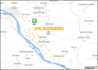
Kialoumadobou (Niamey, Niger)Kialoumadobou is a town in the Niamey region of Niger. An overview map of the region around Kialoumadobou is displayed below.
regional and 3d topo map of Kialoumadobou, Niger ::
Kialoumadobou airports ::
The nearest airport is NIM - Niamey Diori Hamani, located 7.6 km north west of Kialoumadobou.
Nearby towns ::
Sorey (0.3km north east) //
Ouiman Tama (1.9km north) //
Bangoufida (2.6km south west) //
Korozé (2.9km south west) //
Gonzaré (3.1km north) //
Kouté Kwara (4.1km south west) //
Tingobangou (4.1km south west) //
Liboré Zarma (4.1km west) //
Koulou Kouara (5.2km south west) //
Kourteydo (5.3km south west) //
Tiendi Farou (5.4km south west) //
Bangou Banda (5.4km west) //
Liboré (5.5km south west) //
Serkiré Peul (5.7km west) //
Kouara Koukou (5.7km west) //
Ndounga Tarey (6.0km south) //
Abada Goungou (6.2km south west) //
Gonzaré (6.3km north) //
Serkiré Zarma (6.2km west) //
Mallaley (6.3km west) //
Tilbi (6.5km west) //
Tokara (6.6km south west) //
Saga-Aviation (6.6km north west) //
Tiouré Fandou (6.9km north west) //
Gala Béri (7.0km south) //
Bani Goungou (7.2km west) //
Garbel (7.4km north) //
Léley Béri (7.4km west) //
Guinguindé (7.4km west) //
[all distances 'as the bird flies' and approximate] 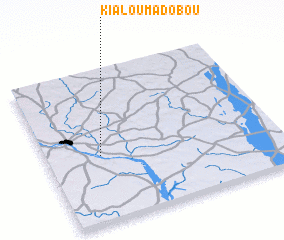 Places with similar names to Kialoumadobou, Niger ::
// Gouloumtouba (BF)
// Galamadibi (ML)
// Galamadibi (ML)
// Gaal Madoobe (SO)
// Gal Madoobe (SO)
// Kỳ Lam Tây (1) (VN)
Disclaimer :: Information on this page comes without warranty of any kind |
||
|
Where is Kialoumadobou? Elevation and coordinates ::
Latitude (lat): 13°26'0"N Longitude (lon): 2°14'0"E
Elevation (approx.): 202m (map arrows pan, magnifying glasses zoom) |
||
|
Visiting Kialoumadobou? Hotel/Accommodation ::
Book a hotel in Kialoumadobou Travel Guide ::
Buy a travel guide for Niger rental cars ::
car rental offers GPS waypoint ::
download a GPX waypoint (PoI) of Kialoumadobou for your GPS receiver
|
||