|
search place name
|
||
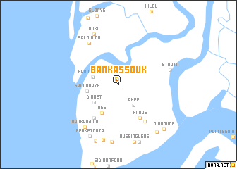
Bankassouk (Ziguinchor, Senegal)Bankassouk is a town in the Ziguinchor region of Senegal. An overview map of the region around Bankassouk is displayed below.
regional and 3d topo map of Bankassouk, Senegal ::
Bankassouk airports ::
The nearest airport is CSK - Cap Skiring, located 32.5 km south of Bankassouk.
Other airports nearby include ZIG - Ziguinchor (50.5 km east), BJL - Banjul Intl (70.7 km north), BXO - Bissau Oswaldo Vieira Intl (146.6 km south east), KLC - Kaolack (175.5 km north east), Nearby towns ::
Ahèr (4.0km south east) //
Kandiankoum (4.2km west) //
Diguèt (4.7km south west) //
Salindiaye (5.0km west) //
Nissi (5.3km south west) //
Kandé (6.3km south east) //
Kotoum (6.5km south west) //
Boufou (7.2km south east) //
Saloulou (7.9km north west) //
Etouta (8.4km east) //
Diankadjoul (8.5km south west) //
Boko (8.8km north west) //
Bourassik (9.0km south) //
Efok Etouta (9.3km south west) //
Kabounkout (9.6km south east) //
Niomoune (9.9km south east) //
[all distances 'as the bird flies' and approximate] 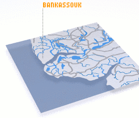 Places with similar names to Bankassouk, Senegal ::
// Bonkiškė (LT)
// Buynaksk (RU)
// Bangassoko (BF)
// Bangozougou (BF)
// Bancahsaga (ID)
// Ban Kasék (LA)
// Ban Naxay (2) (LA)
// Ban Naxôk (LA)
// Ban Naxouak (LA)
// Ban Naxuak (LA)
Disclaimer :: Information on this page comes without warranty of any kind |
||
|
Where is Bankassouk? Elevation and coordinates ::
Latitude (lat): 12°42'10"N Longitude (lon): 16°43'17"W
Elevation (approx.): 6m (map arrows pan, magnifying glasses zoom) |
||
|
Visiting Bankassouk? Hotel/Accommodation ::
Book a hotel in Bankassouk Travel Guide ::
Buy a travel guide for Senegal rental cars ::
car rental offers GPS waypoint ::
download a GPX waypoint (PoI) of Bankassouk for your GPS receiver
|
||