|
search place name
|
||
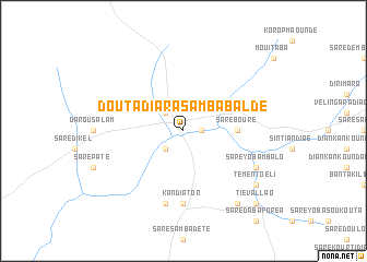
Douta Diara Samba Balde (Kolda, Senegal)Douta Diara Samba Balde is a town in the Kolda region of Senegal. An overview map of the region around Douta Diara Samba Balde is displayed below.
regional and 3d topo map of Douta Diara Samba Balde, Senegal ::
Douta Diara Samba Balde airports ::
The nearest airport is TUD - Tambacounda, located 123.3 km north east of Douta Diara Samba Balde.
Other airports nearby include BXO - Bissau Oswaldo Vieira Intl (175.3 km south west), ZIG - Ziguinchor (195.8 km west), KLC - Kaolack (202.8 km north west), Nearby towns ::
Sintiân Goundo (1.8km east) //
Dinnguiraye (2.6km south west) //
Fafakourou (2.6km north west) //
Saré Bouré (5.4km east) //
Kandiator (7.4km south) //
Alalon (7.6km south) //
Maribé Patimkibo (8.1km south east) //
Saré Yoba Mbalo (8.1km south east) //
Bassoum (9.2km south east) //
Témento Eli (9.1km south east) //
Tiéval Lao (10.4km south east) //
[all distances 'as the bird flies' and approximate]  Places with similar names to Douta Diara Samba Balde, Senegal :: Disclaimer :: Information on this page comes without warranty of any kind |
||
|
Where is Douta Diara Samba Balde? Elevation and coordinates ::
Latitude (lat): 13°3'0"N Longitude (lon): 14°33'0"W
Elevation (approx.): 21m (map arrows pan, magnifying glasses zoom) |
||
|
Visiting Douta Diara Samba Balde? Hotel/Accommodation ::
Book a hotel in Douta Diara Samba Balde Travel Guide ::
Buy a travel guide for Senegal rental cars ::
car rental offers GPS waypoint ::
download a GPX waypoint (PoI) of Douta Diara Samba Balde for your GPS receiver
|
||