|
search place name
|
||
Gobé (Diourbel, Senegal)Gobé is a town in the Diourbel region of Senegal. An overview map of the region around Gobé is displayed below.
regional and 3d topo map of Gobé, Senegal ::

Gobé airports ::
The nearest airport is KLC - Kaolack, located 50.4 km south of Gobé.
Other airports nearby include BJL - Banjul Intl (156.4 km south west), DKR - Dakar Leopold Sedar Senghor Intl (161.3 km west), XLS - St. Louis Saint Louis (168.1 km north), Nearby towns ::
Gohé (1.8km west) //
Diavé (1.9km north) //
Ndioumane (3.7km north) //
Nguidiane (4.0km north west) //
Noukwel (4.0km south east) //
Gapas (5.2km north west) //
Vang (5.4km west) //
Ndoyène (5.8km south) //
Doka (5.8km south) //
Keur Abdou Sakor (5.8km south) //
Keur Sadiouka (5.8km north) //
Touba Mboul (6.5km south east) //
Ngohé (6.5km south west) //
Darou Mbaké (6.6km north east) //
Fas Kaèl (6.5km north east) //
Ladongol (6.5km north east) //
Baïti Dia (6.5km north east) //
Linndé (6.6km north east) //
Parane (7.4km south) //
Loumbel Saye (7.2km west) //
Barkédji Mboul (7.2km east) //
Lagane (7.6km south) //
Goane (7.6km north) //
Loumbel (7.6km north) //
Sipane (7.4km east) //
Met (7.7km south west) //
Mbam (7.7km north west) //
Koèl (7.7km north west) //
Ouada (8.2km north west) //
[all distances 'as the bird flies' and approximate] 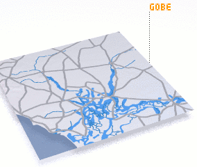 Places with similar names to Gobé, Senegal ::
Disclaimer :: Information on this page comes without warranty of any kind |
||
|
Where is Gobé? Elevation and coordinates ::
Latitude (lat): 14°36'0"N Longitude (lon): 16°0'0"W
Elevation (approx.): 32m (map arrows pan, magnifying glasses zoom) |
||
|
Visiting Gobé? Hotel/Accommodation ::
Book a hotel in Gobé Travel Guide ::
Buy a travel guide for Senegal rental cars ::
car rental offers GPS waypoint ::
download a GPX waypoint (PoI) of Gobé for your GPS receiver
|
||