|
search place name
|
||
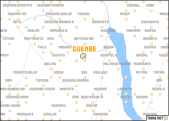
Guembé (Thiès, Senegal)Guembé is a town in the Thiès region of Senegal. An overview map of the region around Guembé is displayed below.
regional and 3d topo map of Guembé, Senegal ::
Guembé airports ::
The nearest airport is DKR - Dakar Leopold Sedar Senghor Intl, located 80.6 km west of Guembé.
Other airports nearby include KLC - Kaolack (92.6 km south east), BJL - Banjul Intl (143.7 km south), XLS - St. Louis Saint Louis (159.8 km north), Nearby towns ::
Keur Soulé Ka (0.0km north) //
Guélor (1.8km west) //
Gas (3.7km south) //
Bayène Diak (3.7km north) //
Mbousnar (4.0km north west) //
Koulouk (5.2km south east) //
Keur Folé (5.4km east) //
Nguinte (5.4km west) //
Soussoum Sanda (5.8km south) //
Badam (5.7km east) //
Diak Bodokhane (6.6km north east) //
Sorok (6.5km south west) //
Koguiane (7.6km south) //
Diéling (7.4km west) //
Mali Keur Koumba (7.4km east) //
Babine Tiakré (7.6km north) //
Dounguel (7.4km west) //
Diol Baba (7.7km north east) //
Mandaguié (7.7km north west) //
Mbafaye (8.2km south west) //
Modiane (8.2km south east) //
Bourvaye (8.2km north east) //
Pamène (8.1km south west) //
Sine (8.1km north west) //
Sangane Bambara (9.2km north west) //
Dara (10.3km south east) //
[all distances 'as the bird flies' and approximate] 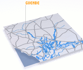 Places with similar names to Guembé, Senegal ::
Disclaimer :: Information on this page comes without warranty of any kind |
||
|
Where is Guembé? Elevation and coordinates ::
Latitude (lat): 14°38'0"N Longitude (lon): 16°45'0"W
Elevation (approx.): 23m (map arrows pan, magnifying glasses zoom) |
||
|
Visiting Guembé? Hotel/Accommodation ::
Book a hotel in Guembé Travel Guide ::
Buy a travel guide for Senegal rental cars ::
car rental offers GPS waypoint ::
download a GPX waypoint (PoI) of Guembé for your GPS receiver
|
||