|
search place name
|
||
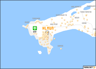
H.L.M. Un (Dakar, Senegal)H.L.M. Un is a town in the Dakar region of Senegal. An overview map of the region around H.L.M. Un is displayed below.
regional and 3d topo map of H.L.M. Un, Senegal ::
H.L.M. Un airports ::
The nearest airport is DKR - Dakar Leopold Sedar Senghor Intl, located 5.5 km north west of H.L.M. Un.
Other airports nearby include KLC - Kaolack (163.0 km south east), BJL - Banjul Intl (175.1 km south east), XLS - St. Louis Saint Louis (181.2 km north east), Nearby towns ::
H.L.M. Deux (0.4km south) //
Usine Parc (0.4km west) //
H.L.M. Trois (0.7km south) //
Bène Tali (0.8km south west) //
Hann-Village (0.9km east) //
H.L.M. Quatre (0.9km south) //
Cité Compagnie des Eaux (0.9km north) //
Quartier Usine (1.0km south west) //
Castors (1.0km north west) //
S.I.C.A.P. Dieupeul (1.1km west) //
Ouagou Niaye (1.1km south west) //
S.I.C.A.P. Liberté Trois (1.1km west) //
Niari Tali (1.2km south west) //
H.L.M. Çinq (1.2km south) //
Hann-Plage (1.2km east) //
Derklé (1.4km north west) //
H.L.M. Six Nimzat (1.5km south) //
Bop (1.6km south) //
Grand Dakar (1.6km south west) //
S.I.C.A.P. Liberté Deux (1.6km west) //
S.I.C.A.P. Liberté Quatre (1.7km west) //
Cité de la Douane (1.8km south) //
Cité du Port de Commerce (1.8km south) //
Hann-Pêcheur (1.8km north east) //
Khar Yalla (1.9km north west) //
S.I.C.A.P. Liberté Çinq (1.9km west) //
S.I.C.A.P. Route des PUITS (1.9km south west) //
S.I.C.A.P. Liberté Un (1.9km west) //
Cerf-Volant (2.0km south) //
[all distances 'as the bird flies' and approximate] 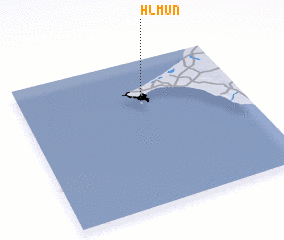 Places with similar names to H.L.M. Un, Senegal ::
Disclaimer :: Information on this page comes without warranty of any kind |
||
|
Where is H.L.M. Un? Elevation and coordinates ::
Latitude (lat): 14°43'6"N Longitude (lon): 17°26'40"W
Elevation (approx.): 20m (map arrows pan, magnifying glasses zoom) |
||
|
Visiting H.L.M. Un? Hotel/Accommodation ::
Book a hotel in H.L.M. Un Travel Guide ::
Buy a travel guide for Senegal rental cars ::
car rental offers GPS waypoint ::
download a GPX waypoint (PoI) of H.L.M. Un for your GPS receiver
|
||