|
search place name
|
||
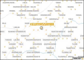
Keur Massamba (Thiès, Senegal)Keur Massamba is a town in the Thiès region of Senegal. An overview map of the region around Keur Massamba is displayed below.
regional and 3d topo map of Keur Massamba, Senegal ::
Keur Massamba airports ::
The nearest airport is DKR - Dakar Leopold Sedar Senghor Intl, located 78.1 km west of Keur Massamba.
Other airports nearby include KLC - Kaolack (114.8 km south east), XLS - St. Louis Saint Louis (131.9 km north), BJL - Banjul Intl (173.4 km south), Nearby towns ::
Keur El Hadji Baké (1.8km east) //
Keur Mbaye Mati (1.8km east) //
Keur Amari Koumba (1.8km west) //
Keur Magayène Sao (2.6km south east) //
Keur Rhali Sorhena (3.6km west) //
Diamaguène (4.1km north east) //
Keur Mogorso (4.0km south east) //
Ka (4.0km north east) //
Sintiou Pir (4.1km north west) //
Mbalène (5.2km south west) //
Keur Assane (5.8km north) //
Keur Chérif Moulaye (5.7km east) //
Ndiassane (5.7km west) //
Keur Matialène (5.7km west) //
Dakar Dodj (6.5km north east) //
Keur Ibra Gueye (6.5km south east) //
Keur Ndiam Ndiaye (6.6km south east) //
Tivaouane (6.6km north west) //
Keur Amadou Ndari (6.6km south west) //
Keur Yoro Assita (7.4km east) //
Dindi Anène (7.6km south) //
Chérif Lo (7.4km west) //
Keur Yoro Safi (8.1km south east) //
Ndiari (8.2km north east) //
Keur Makoumoa (8.2km south east) //
Ngoré Yop (8.1km south west) //
Bangadj (8.2km south west) //
Ngaye Ngaye (9.1km north east) //
Keur Massamba Daguène (9.2km north west) //
[all distances 'as the bird flies' and approximate]  Places with similar names to Keur Massamba, Senegal ::
// Karīm Bāsām (IQ)
// Grimsmo (NO)
// Kermèsamba (SN)
// Keur Massamba (SN)
// Keur Massemba (SN)
// Keur Massemba (SN)
// Keur Massemba (SN)
Disclaimer :: Information on this page comes without warranty of any kind |
||
|
Where is Keur Massamba? Elevation and coordinates ::
Latitude (lat): 14°54'0"N Longitude (lon): 16°47'0"W
Elevation (approx.): 30m (map arrows pan, magnifying glasses zoom) |
||
|
Visiting Keur Massamba? Hotel/Accommodation ::
Book a hotel in Keur Massamba Travel Guide ::
Buy a travel guide for Senegal rental cars ::
car rental offers GPS waypoint ::
download a GPX waypoint (PoI) of Keur Massamba for your GPS receiver
|
||