|
search place name
|
||
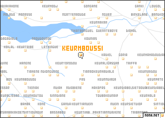
Keur Mboussi (Kaolack, Senegal)Keur Mboussi is a town in the Kaolack region of Senegal. An overview map of the region around Keur Mboussi is displayed below.
regional and 3d topo map of Keur Mboussi, Senegal ::
Keur Mboussi airports ::
The nearest airport is KLC - Kaolack, located 22.6 km north west of Keur Mboussi.
Other airports nearby include BJL - Banjul Intl (115.9 km south west), ZIG - Ziguinchor (171.3 km south), DKR - Dakar Leopold Sedar Senghor Intl (191.0 km north west), CSK - Cap Skiring (204.9 km south west), Nearby towns ::
Tialane (2.6km north west) //
Keur Galo (2.6km north east) //
Keur Biram Paté (2.6km north east) //
Keur Diang (3.7km south) //
Kounias (4.1km north east) //
Keur Yorodou (4.0km south west) //
Keur Mamour Lo (4.0km south west) //
Diéri (4.0km north east) //
Keur Biédi (4.0km north east) //
Bouli (5.2km north east) //
Tiarao Keur Madialé (5.2km south east) //
Médina (5.2km south east) //
Kadiel (5.4km east) //
Tikat Banguel (5.6km north) //
Fas (5.6km south) //
Keur Ali Gassam (5.7km east) //
Daga Youdoum (6.5km south west) //
Keur Dianba Soutra (7.4km north) //
Keur Danba (7.4km west) //
Latmingué (7.4km west) //
Ndiobiène (7.6km south) //
Dilié (7.4km east) //
Guennté Boye (7.7km north east) //
Keur Ndiaga (7.7km south east) //
Keur Dangane (8.1km north west) //
Keur Modi Sala (8.1km south west) //
Ndionguène (8.1km south west) //
Darou Koudous (8.2km south west) //
Keur Makam (8.2km north east) //
[all distances 'as the bird flies' and approximate]  Places with similar names to Keur Mboussi, Senegal ::
Disclaimer :: Information on this page comes without warranty of any kind |
||
|
Where is Keur Mboussi? Elevation and coordinates ::
Latitude (lat): 14°3'0"N Longitude (lon): 15°52'0"W
Elevation (approx.): 26m (map arrows pan, magnifying glasses zoom) |
||
|
Visiting Keur Mboussi? Hotel/Accommodation ::
Book a hotel in Keur Mboussi Travel Guide ::
Buy a travel guide for Senegal rental cars ::
car rental offers GPS waypoint ::
download a GPX waypoint (PoI) of Keur Mboussi for your GPS receiver
|
||