|
search place name
|
||
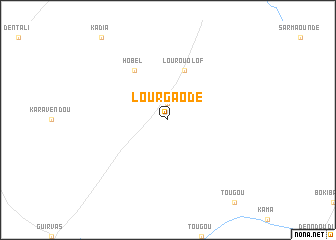
Lour Gaodé (Saint-Louis, Senegal)Lour Gaodé is a town in the Saint-Louis region of Senegal. An overview map of the region around Lour Gaodé is displayed below.
regional and 3d topo map of Lour Gaodé, Senegal ::
Lour Gaodé airports ::
The nearest airport is KED - Kaedi, located 64.8 km north east of Lour Gaodé.
Other airports nearby include BXE - Bakel (205.9 km south east), SEY - Selibabi Selibady (213.1 km east), Nearby towns ::
Lour Harao (1.9km north) //
Lour Ouolof (5.8km north) //
Hobel (6.6km north west) //
[all distances 'as the bird flies' and approximate] 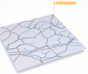 Places with similar names to Lour Gaodé, Senegal ::
// Lărguţa (RO)
// Lèrguiddé (BF)
// Laraquete (CL)
// La Arcadia (CO)
// Lorokida (TP)
// Largaddi (NE)
// Lorkot (PK)
// La Araguata (VE)
// La Recta (VE)
// La Recta (VE)
Disclaimer :: Information on this page comes without warranty of any kind |
||
|
Where is Lour Gaodé? Elevation and coordinates ::
Latitude (lat): 15°54'0"N Longitude (lon): 14°3'0"W
Elevation (approx.): 53m (map arrows pan, magnifying glasses zoom) |
||
|
Visiting Lour Gaodé? Hotel/Accommodation ::
Book a hotel in Lour Gaodé Travel Guide ::
Buy a travel guide for Senegal rental cars ::
car rental offers GPS waypoint ::
download a GPX waypoint (PoI) of Lour Gaodé for your GPS receiver
|
||