|
search place name
|
||
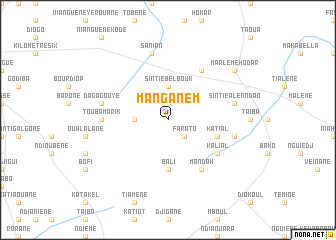
Manganèm (Kaolack, Senegal)Manganèm is a town in the Kaolack region of Senegal. An overview map of the region around Manganèm is displayed below.
regional and 3d topo map of Manganèm, Senegal ::
Manganèm airports ::
The nearest airport is KLC - Kaolack, located 75.0 km west of Manganèm.
Other airports nearby include BJL - Banjul Intl (158.9 km south west), TUD - Tambacounda (188.1 km east), ZIG - Ziguinchor (191.2 km south west), CSK - Cap Skiring (233.7 km south west), Nearby towns ::
Farato (2.6km south east) //
Mbelbouk (3.6km west) //
Sintié Belbouk (3.7km north) //
Bali (5.6km south) //
Katial (5.7km east) //
Kalial (6.5km south east) //
Goudié (6.6km north east) //
Dioli (6.6km south east) //
Mandah (6.6km south east) //
Touba Marik (7.2km west) //
Daga Gouye (7.4km west) //
Sanian (7.6km north) //
Barakounda (7.4km east) //
Sintié Alenndao (7.4km east) //
Marlème Hodar (9.1km north east) //
Malème Hodar (9.1km north east) //
[all distances 'as the bird flies' and approximate]  Places with similar names to Manganèm, Senegal ::
// Maunggonma (MM)
// Möng Nam (MM)
// Möng Nim (MM)
// Möng Nim (MM)
// Manganam (IN)
// Mangunam (KP)
// Mongnemi (KP)
// Mongonimbo (PG)
// Mongnemi (KP)
// Muang Namo (LA)
Disclaimer :: Information on this page comes without warranty of any kind |
||
|
Where is Manganèm? Elevation and coordinates ::
Latitude (lat): 14°2'0"N Longitude (lon): 15°22'0"W
Elevation (approx.): 40m (map arrows pan, magnifying glasses zoom) |
||
|
Visiting Manganèm? Hotel/Accommodation ::
Book a hotel in Manganèm Travel Guide ::
Buy a travel guide for Senegal rental cars ::
car rental offers GPS waypoint ::
download a GPX waypoint (PoI) of Manganèm for your GPS receiver
|
||