|
search place name
|
||
Ndiobène (Thiès, Senegal)Ndiobène is a town in the Thiès region of Senegal. An overview map of the region around Ndiobène is displayed below.
regional and 3d topo map of Ndiobène, Senegal ::

Ndiobène airports ::
The nearest airport is DKR - Dakar Leopold Sedar Senghor Intl, located 66.8 km west of Ndiobène.
Other airports nearby include KLC - Kaolack (119.9 km south east), XLS - St. Louis Saint Louis (138.6 km north), BJL - Banjul Intl (171.0 km south), Nearby towns ::
Ndiarhaté Ndiassane (1.9km north) //
Lalane (1.9km south) //
Keur Assane Ndiaye (2.6km south east) //
Ngoré Yop (3.6km east) //
Lam-Lam (3.7km north) //
Baliga (3.7km north) //
Keur Mamaram (3.7km south) //
Tialé (4.1km south east) //
Diassap (4.1km south west) //
Tiaoune (4.0km south west) //
Keur Matialène (5.7km east) //
Diakhaté (5.8km south) //
Chérif Lo (6.6km north east) //
Darou Ramane (6.5km south west) //
Mbalène (7.2km east) //
Keur Masson (7.4km south) //
Keur Amadou Ndari (7.4km east) //
Kolobane (7.4km west) //
Fandène (7.6km south) //
Keur Issa Bambara (7.6km south) //
Ndiassane (7.7km north east) //
Palo (7.7km north west) //
Keur Rhali Sorhena (8.1km north east) //
Bangadj (8.1km south east) //
Baniaye (9.1km south east) //
Thiès (9.2km south west) //
Keur Yoro Sadio (10.3km south east) //
[all distances 'as the bird flies' and approximate] 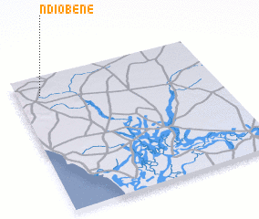 Places with similar names to Ndiobène, Senegal ::
Disclaimer :: Information on this page comes without warranty of any kind |
||
|
Where is Ndiobène? Elevation and coordinates ::
Latitude (lat): 14°52'0"N Longitude (lon): 16°53'0"W
Elevation (approx.): 67m (map arrows pan, magnifying glasses zoom) |
||
|
Visiting Ndiobène? Hotel/Accommodation ::
Book a hotel in Ndiobène Travel Guide ::
Buy a travel guide for Senegal rental cars ::
car rental offers GPS waypoint ::
download a GPX waypoint (PoI) of Ndiobène for your GPS receiver
|
||