|
search place name
|
||
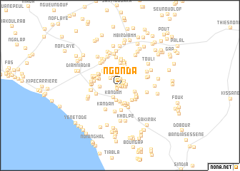
Ngonda (Thiès, Senegal)Ngonda is a town in the Thiès region of Senegal. An overview map of the region around Ngonda is displayed below.
regional and 3d topo map of Ngonda, Senegal ::
Ngonda airports ::
The nearest airport is DKR - Dakar Leopold Sedar Senghor Intl, located 39.8 km west of Ngonda.
Other airports nearby include KLC - Kaolack (130.8 km south east), BJL - Banjul Intl (159.3 km south), XLS - St. Louis Saint Louis (165.1 km north east), Nearby towns ::
Tok Lou Sérère (0.1km south) //
Keur Lamane (0.5km south east) //
Ndourène (0.4km west) //
Gandoul (0.5km north east) //
Kaparok (0.5km east) //
Mbirdiamm (0.8km south west) //
Fotnâri (0.8km north) //
Tok Lou Ouolof (0.8km north east) //
Tankoye (0.9km east) //
Kodang (0.9km north east) //
Khafbʼou (0.9km east) //
Gobi (1.0km north) //
Gandoul Sérère (1.8km north) //
Gandoul Bambara (1.8km north west) //
Gandoul (1.8km north west) //
Kandam (2.1km south west) //
Tok Lou Ouolof (2.4km south) //
Ndénglé (2.6km south) //
Mboyenâk (2.5km south east) //
Yéba Inda (2.8km north) //
Boukhou (2.9km south) //
Los (2.9km south) //
Filène (2.9km south east) //
Bʼounounga (3.0km south east) //
Bounga (3.0km west) //
Yéba II (3.1km north) //
Garas (3.1km south) //
Pâki (3.1km south east) //
Bôkhogne (3.1km south east) //
[all distances 'as the bird flies' and approximate] 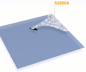 Places with similar names to Ngonda, Senegal ::
Disclaimer :: Information on this page comes without warranty of any kind |
||
|
Where is Ngonda? Elevation and coordinates ::
Latitude (lat): 14°42'8"N Longitude (lon): 17°7'20"W
Elevation (approx.): 40m (map arrows pan, magnifying glasses zoom) |
||
|
Visiting Ngonda? Hotel/Accommodation ::
Book a hotel in Ngonda Travel Guide ::
Buy a travel guide for Senegal rental cars ::
car rental offers GPS waypoint ::
download a GPX waypoint (PoI) of Ngonda for your GPS receiver
|
||