|
search place name
|
||
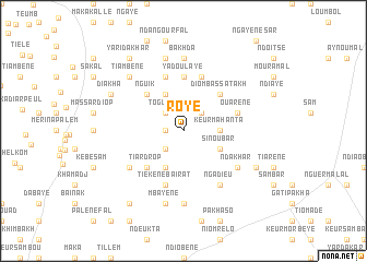
Roye (Louga, Senegal)Roye is a town in the Louga region of Senegal. An overview map of the region around Roye is displayed below.
regional and 3d topo map of Roye, Senegal ::
Roye airports ::
The nearest airport is XLS - St. Louis Saint Louis, located 44.7 km north west of Roye.
Other airports nearby include KLC - Kaolack (181.4 km south), DKR - Dakar Leopold Sedar Senghor Intl (184.6 km south west), Nearby towns ::
Ouadane (1.8km west) //
Aloulaye (2.6km south west) //
Mbirama (2.6km north east) //
Togueul (2.6km north west) //
Keur Mahanta (3.6km east) //
Sinoubar (4.0km south east) //
Tialla (4.1km south west) //
Baïrat (4.1km south west) //
Maka Gaye (4.1km north west) //
Ndiayène (4.1km north west) //
Tiar Drop (5.1km south west) //
Keur Mèïssa (5.1km south west) //
Diom Bassatakh (5.1km north east) //
Nguik (5.1km north west) //
Yadou Laye (5.6km north) //
Ouarène (5.7km east) //
Tiar Hal (5.8km north) //
Keur Amado (5.8km north) //
Tiékène Baïrat (5.8km south) //
Ndakhar (6.5km south east) //
Ngadieu (6.6km south east) //
Ndia (6.6km south east) //
Keur Paté (6.5km south west) //
Diakhaslène (7.4km south) //
Bakhda (7.4km north) //
Mbayène (7.6km south) //
Keur Ibra (7.6km north) //
Tiambène (7.7km north west) //
Pénédji (8.0km south east) //
[all distances 'as the bird flies' and approximate] 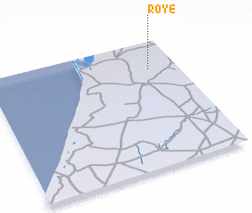 Places with similar names to Roye, Senegal ::
Disclaimer :: Information on this page comes without warranty of any kind |
||
|
Where is Roye? Elevation and coordinates ::
Latitude (lat): 15°47'0"N Longitude (lon): 16°9'0"W
Elevation (approx.): 33m (map arrows pan, magnifying glasses zoom) |
||
|
Visiting Roye? Hotel/Accommodation ::
Book a hotel in Roye Travel Guide ::
Buy a travel guide for Senegal rental cars ::
car rental offers GPS waypoint ::
download a GPX waypoint (PoI) of Roye for your GPS receiver
|
||