|
search place name
|
||
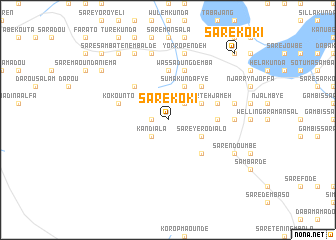
Saré Koki (Kolda, Senegal)Saré Koki is a town in the Kolda region of Senegal. An overview map of the region around Saré Koki is displayed below.
regional and 3d topo map of Saré Koki, Senegal ::
Saré Koki airports ::
The nearest airport is TUD - Tambacounda, located 103.2 km north east of Saré Koki.
Other airports nearby include BXO - Bissau Oswaldo Vieira Intl (197.8 km south west), KLC - Kaolack (198.1 km north west), ZIG - Ziguinchor (211.4 km west), BXE - Bakel (279.0 km north east), Nearby towns ::
Tabayel Bouraïma (1.8km west) //
Kandiala (2.6km south west) //
Saré Ndiobo (2.6km north east) //
Sare Luntang (4.1km north east) //
Sare Biram (4.1km north east) //
Sumakunda Fye (4.1km north east) //
Baniko (4.1km north east) //
Sare Parteh Jameh (4.1km north east) //
Saré Dianko (4.1km south east) //
Saré Yéro Dialo (4.1km south east) //
Jimara (4.1km north east) //
Birom (4.1km north east) //
Suma Kunda Bakary (5.2km north west) //
Suma Kunda (5.2km north east) //
Sumakunda Bakary (5.2km north east) //
Dioulagueul Banta (5.2km south east) //
Sare Cherno (5.4km east) //
Sare Maunde (5.4km east) //
Sare Samba Jidah (5.6km north) //
Sare Dadeh (5.7km east) //
Wassadung Demba (5.8km north) //
Kodiolo (5.7km west) //
Sare Demba Dardoh (5.8km north) //
Kokounto (5.7km west) //
Sare Sarjo Biloh (7.2km east) //
Temanto Demba Jamang (7.6km north) //
Madina Sadda (7.4km east) //
Jum Bakary (7.6km north) //
Yorro Pendeh (7.6km north) //
[all distances 'as the bird flies' and approximate] 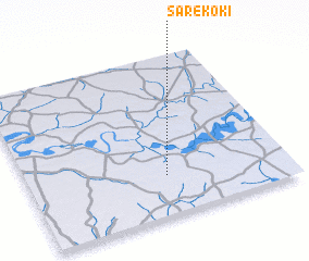 Places with similar names to Saré Koki, Senegal ::
// Siricucu (BR)
// Suracqua (CH)
// Cerro Gago (PA)
// Sirakaíika (GR)
// Sierakówko (PL)
// Sarıkoç (TR)
// Sarıkoç (TR)
// Sirkeköy (TR)
// Sürgüç (TR)
// Sürgücü (TR)
Disclaimer :: Information on this page comes without warranty of any kind |
||
|
Where is Saré Koki? Elevation and coordinates ::
Latitude (lat): 13°15'0"N Longitude (lon): 14°28'0"W
Elevation (approx.): 42m (map arrows pan, magnifying glasses zoom) |
||
|
Visiting Saré Koki? Hotel/Accommodation ::
Book a hotel in Saré Koki Travel Guide ::
Buy a travel guide for Senegal rental cars ::
car rental offers GPS waypoint ::
download a GPX waypoint (PoI) of Saré Koki for your GPS receiver
|
||