|
search place name
|
||
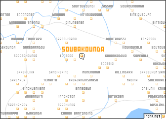
Soubakounda (Tambacounda, Senegal)Soubakounda is a town in the Tambacounda region of Senegal. An overview map of the region around Soubakounda is displayed below.
regional and 3d topo map of Soubakounda, Senegal ::
Soubakounda airports ::
The nearest airport is TUD - Tambacounda, located 49.5 km east of Soubakounda.
Other airports nearby include KLC - Kaolack (221.7 km west), BXE - Bakel (223.5 km north east), KGG - Kedougou (230.9 km south east), BXO - Bissau Oswaldo Vieira Intl (252.9 km south west), Nearby towns ::
Diatassaba (1.8km west) //
Tonboro (3.6km west) //
Kandékounda (4.1km south east) //
Mure Kunda (4.1km south east) //
Saré Kolinnka (4.1km south west) //
Saré Eli Sandi (5.2km north west) //
Tabajang Kisimasu (5.6km south) //
Saré Sidi (5.7km east) //
Gayo (5.8km south) //
Jahatuje (5.8km south) //
Sandikéring (6.6km south west) //
Gunjur Kuta (6.6km south west) //
Jekka (6.6km south west) //
Sare Geda (7.4km south) //
Kouonko Doua (7.2km east) //
Dialassaba (7.6km north) //
Dioutabassi (8.1km north east) //
Témanto (9.1km south west) //
[all distances 'as the bird flies' and approximate]  Places with similar names to Soubakounda, Senegal ::
// Sub-Quintão (PT)
// Sibkundi (BD)
// Sabu Kunda (GM)
// Saboukondo (GN)
// Subékandé (GN)
// Sabuiacunda (GW)
// Sibicunto (GW)
Disclaimer :: Information on this page comes without warranty of any kind |
||
|
Where is Soubakounda? Elevation and coordinates ::
Latitude (lat): 13°35'0"N Longitude (lon): 14°5'0"W
Elevation (approx.): 43m (map arrows pan, magnifying glasses zoom) |
||
|
Visiting Soubakounda? Hotel/Accommodation ::
Book a hotel in Soubakounda Travel Guide ::
Buy a travel guide for Senegal rental cars ::
car rental offers GPS waypoint ::
download a GPX waypoint (PoI) of Soubakounda for your GPS receiver
|
||