|
search place name
|
||
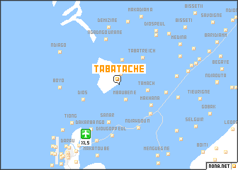
Taba Tache (Saint-Louis, Senegal)Taba Tache is a town in the Saint-Louis region of Senegal. An overview map of the region around Taba Tache is displayed below.
regional and 3d topo map of Taba Tache, Senegal ::
Taba Tache airports ::
The nearest airport is XLS - St. Louis Saint Louis, located 9.2 km south west of Taba Tache.
Other airports nearby include DKR - Dakar Leopold Sedar Senghor Intl (191.4 km south west), KLC - Kaolack (221.8 km south), NKC - Nouakschott Nouakchott (224.5 km north), Nearby towns ::
Taba Ahmétou (1.8km north) //
Mbaubène (2.5km south east) //
Mbéraye (3.3km north east) //
Taba Darou Salam I (4.0km north) //
Tamach (4.5km east) //
Taba Treich (5.6km north east) //
Sanar (6.0km south) //
Makhana (5.9km south east) //
Dios (5.9km south west) //
Mbarigo (6.6km south east) //
Ndiawdoun (7.3km south east) //
Ngad Ngourane (7.4km north) //
Lamsar (7.2km east) //
Diougop Peul (8.0km south) //
Dakar Bango (8.2km south west) //
Ngalel (9.4km south) //
Tiong (9.3km south west) //
Amoura (9.7km north east) //
Dios Peul (10.2km north east) //
Treich Peul (11.1km north east) //
Bop Tior (11.1km south west) //
[all distances 'as the bird flies' and approximate] 
Disclaimer :: Information on this page comes without warranty of any kind |
||
|
Where is Taba Tache? Elevation and coordinates ::
Latitude (lat): 16°7'13"N Longitude (lon): 16°24'58"W
Elevation (approx.): 8m (map arrows pan, magnifying glasses zoom) |
||
|
Visiting Taba Tache? Hotel/Accommodation ::
Book a hotel in Taba Tache Travel Guide ::
Buy a travel guide for Senegal rental cars ::
car rental offers GPS waypoint ::
download a GPX waypoint (PoI) of Taba Tache for your GPS receiver
|
||