|
search place name
|
||
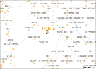
Tatène (Thiès, Senegal)Tatène is a town in the Thiès region of Senegal. An overview map of the region around Tatène is displayed below.
regional and 3d topo map of Tatène, Senegal ::
Tatène airports ::
The nearest airport is DKR - Dakar Leopold Sedar Senghor Intl, located 64.1 km west of Tatène.
Other airports nearby include KLC - Kaolack (108.1 km south east), BJL - Banjul Intl (149.4 km south), XLS - St. Louis Saint Louis (160.2 km north), Nearby towns ::
Sassène (2.6km north west) //
Noto (4.1km north east) //
Polam Rok (4.1km south west) //
Keur Demba Kébé (5.2km north east) //
Bonboye (5.2km north west) //
Pout Ndiack (5.4km east) //
Babak (5.6km north) //
Ngolar (5.7km east) //
Goté (5.7km east) //
Keur Matar (5.8km north) //
Keur Ibra Fal (5.8km north) //
Golfangning (5.7km west) //
Sangué (6.5km north west) //
Keur Sadarou Fam (7.6km north) //
Kissane (7.4km west) //
Tialé (7.4km east) //
Keur Yelnak (7.7km north east) //
Keur Tiem Savaré (8.2km north west) //
Keur Mori Fal (8.1km north east) //
Tassèt Ouolof (8.2km south east) //
Darou Fal (9.2km north west) //
Anène (10.3km north east) //
[all distances 'as the bird flies' and approximate] 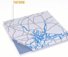 Places with similar names to Tatène, Senegal ::
Disclaimer :: Information on this page comes without warranty of any kind |
||
|
Where is Tatène? Elevation and coordinates ::
Latitude (lat): 14°40'0"N Longitude (lon): 16°54'0"W
Elevation (approx.): 80m (map arrows pan, magnifying glasses zoom) |
||
|
Visiting Tatène? Hotel/Accommodation ::
Book a hotel in Tatène Travel Guide ::
Buy a travel guide for Senegal rental cars ::
car rental offers GPS waypoint ::
download a GPX waypoint (PoI) of Tatène for your GPS receiver
|
||