|
search place name
|
||
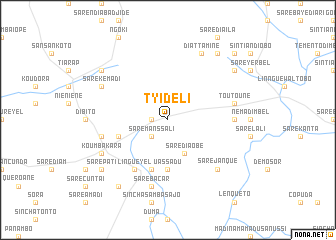
Tyidéli (Kolda, Senegal)Tyidéli is a town in the Kolda region of Senegal. An overview map of the region around Tyidéli is displayed below.
regional and 3d topo map of Tyidéli, Senegal ::
Tyidéli airports ::
The nearest airport is TUD - Tambacounda, located 138.5 km north east of Tyidéli.
Other airports nearby include BXO - Bissau Oswaldo Vieira Intl (163.4 km south west), ZIG - Ziguinchor (203.6 km west), KLC - Kaolack (236.2 km north west), Nearby towns ::
Kidéli Dimbel (1.8km west) //
Saré Manssali (2.6km south west) //
Saré Diaobé (4.1km south east) //
Uassadu (5.6km south) //
Kadanga (5.6km south) //
Mérévé (5.7km west) //
Koulinnto (5.8km south) //
Linguéyel (6.6km south west) //
Didioré (7.2km east) //
Sare Bácar (7.6km south) //
Niandinndia Dimbel (7.5km west) //
Toutouné (7.5km east) //
Sare Janque (7.8km south east) //
Koumbakara (8.1km south west) //
Saré Karfa (8.1km north west) //
Saré Kémadi (8.1km north west) //
Kanikoro (8.1km north west) //
Diattamine (8.2km north east) //
Madina Demba Seidi (9.2km south west) //
Lenquetó (9.2km south west) //
Saré Abdoulaye (9.1km north west) //
Sare Pati (9.1km south west) //
Saré Diobo (9.1km north east) //
Saré Gourdo (9.2km north east) //
Saré Dimbayel (10.4km north east) //
[all distances 'as the bird flies' and approximate]  Places with similar names to Tyidéli, Senegal ::
Disclaimer :: Information on this page comes without warranty of any kind |
||
|
Where is Tyidéli? Elevation and coordinates ::
Latitude (lat): 12°44'0"N Longitude (lon): 14°25'0"W
Elevation (approx.): 57m (map arrows pan, magnifying glasses zoom) |
||
|
Visiting Tyidéli? Hotel/Accommodation ::
Book a hotel in Tyidéli Travel Guide ::
Buy a travel guide for Senegal rental cars ::
car rental offers GPS waypoint ::
download a GPX waypoint (PoI) of Tyidéli for your GPS receiver
|
||