|
search place name
|
||
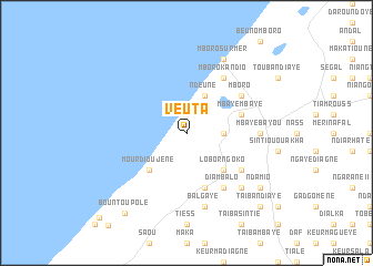
Veuta (Thiès, Senegal)Veuta is a town in the Thiès region of Senegal. An overview map of the region around Veuta is displayed below.
regional and 3d topo map of Veuta, Senegal ::
Veuta airports ::
The nearest airport is DKR - Dakar Leopold Sedar Senghor Intl, located 71.5 km south west of Veuta.
Other airports nearby include XLS - St. Louis Saint Louis (115.8 km north east), KLC - Kaolack (144.5 km south east), BJL - Banjul Intl (199.4 km south), Nearby towns ::
Keur Paté Ndiaye (3.6km east) //
Ndeune (4.1km north east) //
Lobor Ngoko (5.2km south east) //
Mourdioujène (5.2km south west) //
Mbaye Mbaye (5.7km east) //
Darou Fal (5.8km south) //
Diambalo (6.6km south east) //
Mboro Kandio (6.6km north east) //
Mboro (6.5km north east) //
Keur Gora Ndong (6.5km south east) //
Mbaye Bayou (7.2km east) //
Bal Gaye (7.6km south) //
Darou Dia (7.7km south east) //
Mboro-sur-Mer (8.2km north east) //
Ndamio (9.1km south east) //
Bountou Polé (10.1km south west) //
Taïba Ndiaye (10.3km south east) //
Keur Mam Awa (12.0km south west) //
[all distances 'as the bird flies' and approximate]  Places with similar names to Veuta, Senegal ::
Disclaimer :: Information on this page comes without warranty of any kind |
||
|
Where is Veuta? Elevation and coordinates ::
Latitude (lat): 15°7'0"N Longitude (lon): 16°57'0"W
Elevation (approx.): 12m (map arrows pan, magnifying glasses zoom) |
||
|
Visiting Veuta? Hotel/Accommodation ::
Book a hotel in Veuta Travel Guide ::
Buy a travel guide for Senegal rental cars ::
car rental offers GPS waypoint ::
download a GPX waypoint (PoI) of Veuta for your GPS receiver
|
||