|
search place name
|
||
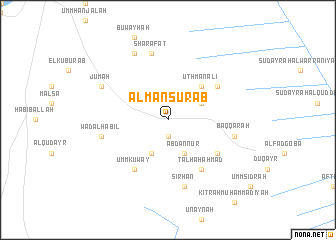
Al Manşūrāb ((( Al Wusţá )), Sudan)Al Manşūrāb is a town in the (( Al Wusţá )) region of Sudan. An overview map of the region around Al Manşūrāb is displayed below.
regional and 3d topo map of Al Manşūrāb, Sudan ::
Al Manşūrāb airports ::
The nearest airport is KRT - Khartoum, located 51.9 km north of Al Manşūrāb.
Nearby towns ::
Umm Ţarafāyah (1.9km south) //
‘Abd an Nūr (4.1km south east) //
Umm Huwayd (4.1km south west) //
Ḩujjāj (4.0km north east) //
‘Uthmān ‘Alī (5.2km north east) //
Busatab (6.5km south east) //
Ţalḩah Aḩmad (6.6km south east) //
Dubaysah (6.5km north east) //
Umm Kuway‘ (6.6km south west) //
Baqqārah (7.4km east) //
Sirḩān (7.6km south) //
Wad al Habīl (7.4km west) //
Sharafāt (7.6km north) //
Jum‘ah (8.1km north west) //
Al Farajāb (8.2km north west) //
[all distances 'as the bird flies' and approximate] 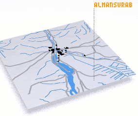 Places with similar names to Al Manşūrāb, Sudan :: Disclaimer :: Information on this page comes without warranty of any kind |
||
|
Where is Al Manşūrāb? Elevation and coordinates ::
Latitude (lat): 15°8'0"N Longitude (lon): 32°40'0"E
Elevation (approx.): 392m (map arrows pan, magnifying glasses zoom) |
||
|
Visiting Al Manşūrāb? Hotel/Accommodation ::
Book a hotel in Al Manşūrāb Travel Guide ::
Buy a travel guide for Sudan rental cars ::
car rental offers GPS waypoint ::
download a GPX waypoint (PoI) of Al Manşūrāb for your GPS receiver
|
||