|
search place name
|
||
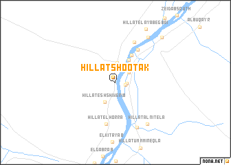
Hillat Shootak (Nahr an Nīl, Sudan)Hillat Shootak is a town in the Nahr an Nīl region of Sudan. An overview map of the region around Hillat Shootak is displayed below.
regional and 3d topo map of Hillat Shootak, Sudan ::
Hillat Shootak airports ::
The nearest airport is KRT - Khartoum, located 224.2 km south west of Hillat Shootak.
Nearby towns ::
El Giref (1.7km east) //
Buqlab (1.7km east) //
Hillat el Qilea (2.0km north) //
Hillat Hadad (2.4km north) //
Hillat el Fiqera (2.6km north east) //
El El‘iqeda (3.2km north) //
El Higelab (3.2km north east) //
Hillat esh Shiwerib (3.6km south west) //
Wad Bakhet (4.1km north east) //
El Haraza (5.1km north east) //
Qirenab (6.3km north east) //
Hillat el Horra (6.9km south) //
Hillat el Karada (7.2km north east) //
Qabati (8.1km south east) //
Hillat Alnitela (8.3km south east) //
Hillat el Qussa (8.9km north east) //
Hillat el ‘Ayabegbai (9.9km north east) //
Hillat el Hawya (10.3km north east) //
[all distances 'as the bird flies' and approximate] 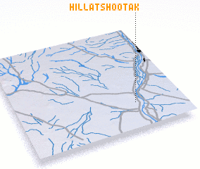 Places with similar names to Hillat Shootak, Sudan :: Disclaimer :: Information on this page comes without warranty of any kind |
||
|
Where is Hillat Shootak? Elevation and coordinates ::
Latitude (lat): 17°16'9"N Longitude (lon): 33°43'36"E
Elevation (approx.): 356m (map arrows pan, magnifying glasses zoom) |
||
|
Visiting Hillat Shootak? Hotel/Accommodation ::
Book a hotel in Hillat Shootak Travel Guide ::
Buy a travel guide for Sudan rental cars ::
car rental offers GPS waypoint ::
download a GPX waypoint (PoI) of Hillat Shootak for your GPS receiver
|
||