|
search place name
|
||
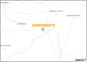
Muḩammadayn ((( Al Wusţá )), Sudan)Muḩammadayn is a town in the (( Al Wusţá )) region of Sudan. An overview map of the region around Muḩammadayn is displayed below.
regional and 3d topo map of Muḩammadayn, Sudan ::
Nearby towns ::
Rashid aţ Ţayyib (9.2km north east) //
[all distances 'as the bird flies' and approximate] 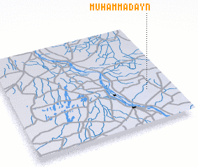 Places with similar names to Muḩammadayn, Sudan ::
// Muḩammadayn (SD)
// Moḩammadān (IR)
// Moḩammadān (IR)
// Muhammadan (PK)
// Muhammadāna (PK)
// Muhammad Dāni (PK)
// Mohomtienai (PG)
// Mohomtienai (PG)
Disclaimer :: Information on this page comes without warranty of any kind |
||
|
Where is Muḩammadayn? Elevation and coordinates ::
Latitude (lat): 13°21'0"N Longitude (lon): 32°51'0"E
Elevation (approx.): 410m (map arrows pan, magnifying glasses zoom) |
||
|
Visiting Muḩammadayn? Hotel/Accommodation ::
Book a hotel in Muḩammadayn Travel Guide ::
Buy a travel guide for Sudan rental cars ::
car rental offers GPS waypoint ::
download a GPX waypoint (PoI) of Muḩammadayn for your GPS receiver
|
||