|
search place name
|
||
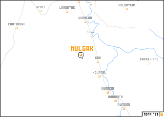
Mulgak (Sudan)Mulgak is a town in Sudan. An overview map of the region around Mulgak is displayed below.
regional and 3d topo map of Mulgak, Sudan ::
Mulgak airports ::
The nearest airport is MAK - Malakal, located 60.2 km north of Mulgak.
Nearby towns ::
 Places with similar names to Mulgak, Sudan ::
// Mialkougou (CM)
// Mèlako-auk (MM)
// Mǝlcǝk (AZ)
// Malaguikay (PH)
// Milokokkiá (GR)
// Melgaço (PT)
// Malakówka (PL)
// Mały Kack (PL)
// Miłkówko (PL)
// Mallkeq (AL)
Disclaimer :: Information on this page comes without warranty of any kind |
||
|
Where is Mulgak? Elevation and coordinates ::
Latitude (lat): 9°1'12"N Longitude (lon): 31°43'52"E
Elevation (approx.): 401m (map arrows pan, magnifying glasses zoom) |
||
|
Visiting Mulgak? Hotel/Accommodation ::
Book a hotel in Mulgak Travel Guide ::
Buy a travel guide for Sudan rental cars ::
car rental offers GPS waypoint ::
download a GPX waypoint (PoI) of Mulgak for your GPS receiver
|
||