|
search place name
|
||
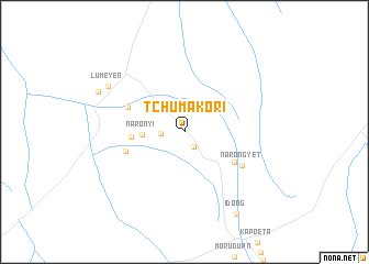
Tchumakori ((( Al Istiwāʼīyah )), Sudan)Tchumakori is a town in the (( Al Istiwāʼīyah )) region of Sudan. An overview map of the region around Tchumakori is displayed below.
regional and 3d topo map of Tchumakori, Sudan ::
Tchumakori airports ::
The nearest airport is JUB - Juba, located 213.2 km west of Tchumakori.
Nearby towns ::
Lolepon (1.8km south east) //
Nakoret (2.4km west) //
Naronyi (4.3km west) //
Nagongitela (5.5km west) //
Lomeyen (5.9km south east) //
Lokwamiro (6.2km west) //
Lomonichek (6.2km north west) //
Narongyet (6.7km south east) //
Lumeyen (9.1km north west) //
Nawayareng (9.6km north west) //
Idong (9.8km south east) //
[all distances 'as the bird flies' and approximate] 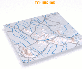 Places with similar names to Tchumakori, Sudan ::
// Tchimokro (CI)
Disclaimer :: Information on this page comes without warranty of any kind |
||
|
Where is Tchumakori? Elevation and coordinates ::
Latitude (lat): 4°52'23"N Longitude (lon): 33°31'24"E
Elevation (approx.): 618m (map arrows pan, magnifying glasses zoom) |
||
|
Visiting Tchumakori? Hotel/Accommodation ::
Book a hotel in Tchumakori Travel Guide ::
Buy a travel guide for Sudan rental cars ::
car rental offers GPS waypoint ::
download a GPX waypoint (PoI) of Tchumakori for your GPS receiver
|
||