|
search place name
|
||
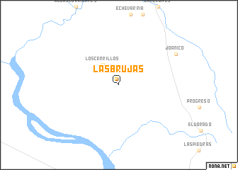
Las Brujas (Canelones, Uruguay)Las Brujas is a town in the Canelones region of Uruguay. An overview map of the region around Las Brujas is displayed below.
regional and 3d topo map of Las Brujas, Uruguay ::
Las Brujas airports ::
The nearest airport is MVD - Montevideo Angel S Adami, located 18.4 km south of Las Brujas.
Other airports nearby include MVD - Montevideo Carrasco Intl (35.8 km south east), LPG - La Plata (147.7 km west), Nearby towns ::
Los Cerrillos (3.8km north west) //
[all distances 'as the bird flies' and approximate]  Places with similar names to Las Brujas, Uruguay ::
// Las Brujas (PA)
// Los Borges (CU)
// Las Barajas (CO)
// Las Brujas (PE)
// Las Brujas (VE)
// Las Brujas (VE)
// Les Bergeas (FR)
Disclaimer :: Information on this page comes without warranty of any kind |
||
|
Where is Las Brujas? Elevation and coordinates ::
Latitude (lat): 34°38'0"S Longitude (lon): 56°20'0"W
Elevation (approx.): 13m (map arrows pan, magnifying glasses zoom) |
||
|
Visiting Las Brujas? Hotel/Accommodation ::
Book a hotel in Las Brujas Travel Guide ::
Buy a travel guide for Uruguay rental cars ::
car rental offers GPS waypoint ::
download a GPX waypoint (PoI) of Las Brujas for your GPS receiver
|
||